The North Cornwall section of the path has wonderful beaches, Atlantic Breakers and some rugged and beautiful scenery. From the very north of the coast near Bude, past the famous Tintagel Castle, the camel estuary near Padstow, the popular resorts of Newquay and St. Ives to Lands End, the very south west corner of England.


Hartland Quay to Bude
This is perhaps the longest, toughest and most spectacular walk along the South West Coast Path. It begins from the remote Hartland Quay and follows the coast south for around 16 miles to the popular resort of Bude. On the way you will climb to the top of the cliffs and then back down to sea level many times, but this makes for some spectacular scenery and numerous waterfalls. The walk passes through no villages or towns on the way and so is very remote.
Crackington Haven to Bude
This walk begins by following the cliff top path along the high cliffs between Crackington Haven and Widemouth Bay. Widemouth Bay itself is a beautiful wide sandy beach, backed by low cliffs. From Widemouth north the walk is realtively flat all the way into the resort town of Bude, with several excellent sandy beaches and the interesting Bude canal.
This is a stunning walk starting from the spectacular location of Tintagel with it's castle and heading north along one of the most beautiful parts of the coast, passing Rocky Valley to the beautiful harbour village of Boscastle, a welcome refuge for boats on this rugged part of the coast. North of Boscastle the path becomes steeper and the cliffs higher, offering some stunning views. The walk ends at the small village of Crackington Haven with it's narrow sandy beach. Note - this walk replaces the former Boscastle to Tinagel walk on this site.

Port Isaac to Tintagel
This walk begins in the beautiful village of Port Isaac and heads north east along the coast to Tintagel, legendary bith place of King Arthur and home to a spectacular castle. The walk takes in some fairly remote and rocky parts of the coast and also passes two sandy beaches, at Tregardock and Trebarwith Strand, although at high tide both beaches are covered.
Rock to Port Isaac
Rock to Port Isaac
This walk shows the huge variety of scenery along the coast path. From Rock the walk head north through extensive sand dunes beside the Camel estuary to the popular beach of Polzeath. Continuing east the walk rounds Pentire Point, rather like moorland beside the sea with it's rock outcrops and roaming sheep. Continuing east the walk passes the remote harbour at Port Quinn and round the coast to Port Isaac, a beautiful little port crammed into a steep valley and used as the location for many TV series.
Padstow to Constantine
The pretty town of Padstow is the starting point for this walk. The walk runs next to the River Camel, giving views of Rock and Polzeath before coming out onto the coast. There are some of the best beaches in North Cornwall along this part of the coast. Rounding Trevose Head gives excellent views around the coast before arriving at Constantine Bay, another excellent beach.
Newquay to Mawgan Porth
This walks starts in the popular holiday resort of Newquay. This area is famous for it's beaches and on this walk you'll be passing excellent beaches the whole way. This walk passes through the many bays of Newquay and on past the popular surfers beach at Watergate Bay to the smaller beach at Mawgan Porth.
Perranporth to Newquay
This is certainly a walk to save for a sunny day as it takes in some of North Cornwalls best beaches. Beginning from Perranporth we follow the the golden sands of Perran Beach for almost 2 miles and after another mile or so arrive at Holywell Bay with it's massive dunes. The walk continues passing the more remote and beautiful Porth Joke and on to Crantock Beach, another lovely sandy beach. From here cross the river Gannel (this may require a lengthy diversion inland at high tide) to Pentire point and then the famous Fistral beach, continuing to the centre of the popular resort of Newquay.
Perranporth to St Agnes
Portreath to Perranporth
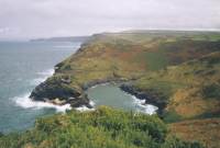
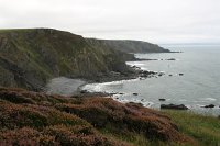
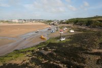
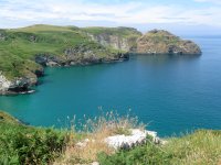
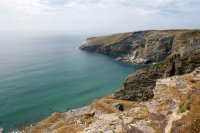
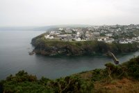
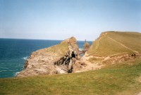
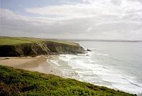
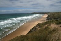
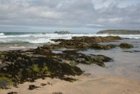
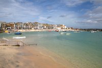
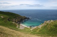
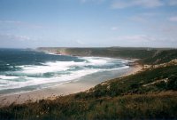
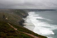
This walk is a good summary of the scenery of Cornwall. It begins from the town of Portreath, once a busy port and with a good sandy beach and heads north past Gooden Heane Cove and to the large sandy beach at Porthtowan. At the north end of this beach, overlooking Chapel Porth is the disused Wheal Coates mine, a landmark on this part of the coast and an indication of the intense mining that once happened right accross the county. From here the coast becomes more rocky as you round St Agnes head and descend to Trevaunance Cove, a sand and rock beach. Just beyond this beach is another steep mining valley and you then pass a small airfield to descend to Perranporth, with it's large sandy beach and huge dune system - a classic Cornish beach.
Lelant to Portreath
Lelant to Portreath
This walk begins by rounding the Hayle Estuary, an interesting area of marshes and river but also with some road walking. From the mouth of the estuary we then pass the glorious sandy beach of Hayle Towans that runs for a couple of miles to Godrevey Point and lighthouse. East from here the walk is more rocky, passing numerous rocky bays including Hells Mouth to finish in the village of Portreath with it's sandy beach and small harbour.
Zennor to Lelant
Zennor to Lelant
This walk is really a walk of two halves. The first follows the spectacular rocky coast of Penwith, the far west of Cornwall with high granite cliffs and rocky coves. Soon you arrive in the beautiful town of St Ives (where the walk could be split if you prefer a shorter walk) and from here eastwards the character of the walk changes with the numerous sandy beaches of this wide sweeping bay being the main scenery.
Zennor to Cape Cornwall
This walk in the Penwith area, in the very far west of Cornwall, begins fron Zennor and heads along the rocky cliffs, passing some rocky and sandy beaches on the way. Soon you reach the beautiful Portheras Cove with it's beautiful white sand and continues west to Pendeen Watch with it's lighthouse. Heading west from here the walk passes some of Cornwalls extensive mining heritage passing the mines and engine houses at Geevor, Levant and Botallack. The walk ends at Cape Cornwall although to return to Zennor you will need to walk a mile or so inland to the town of St Just.
Lands End to Sennen Cove
The most westerly point of the coast path, Lands End, is the start point for this short walk to Sennen Cove. Although short, this walk takes in some spectacular scenery with rocky headlands at Lands End, down to the glorious beach of Whitesand Bay at Sennen Cove.


Comments? Email webmaster@explorethesouthwestcoastpath.co.uk