 |
|
|
| Distance : 9 miles | Grading : ++++ | OS Sheet : 111 |
This walk begins by following the cliff top path along the high cliffs between Crackington Haven and Widemouth Bay. Widemouth Bay itself is a beautiful wide sandy beach, backed by low cliffs. From Widemouth north the walk is realtively flat all the way into the resort town of Bude, with several excellent sandy beaches and the interesting Bude canal.
From the A39 just south of Bude, at Wainhouse Corner turn right (if coming from the direction of Bude) or left (if coming from the direction of Tintagel) onto the road signed for Crackington Haven. This takes you through Coxford and then down into Crackington Haven itself. Note that the road is single track (with passing places) and descends very steeply down into Crackington Haven, so great care is needed. There is a pay and display car park just on the left as you come down to the sea front.
Crackington Haven is served by bus service 595 which runs around once every two hours from Bude to Boscastle via Crackington Haven. Most buses on the route also run south from Boscastle to Tintagel, Camelford, Wadebridge and St Column Major. The bus runs seven days a week during the summer and Monday - Saturday only during the winter months. For details, please see the link below.
Accommodation in Crackington Haven is limited. The Coombe Barton Inn in the centre of the village, right by the coast has a limited number of rooms. For details call 01840 230345. Hallagather Farmhouse offers bed and breakfast accommodation and is around a 20 minute walk along footpaths from the sea front and coast path. Otherwise there are a few holiday cottages and camp sites nearby or you'll fine a much wider range of accommodation in nearby Bude or Tintagel.
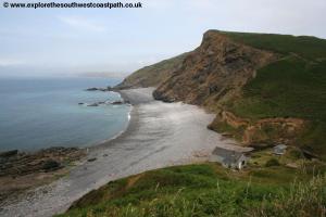
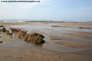
Crackington Haven has a stunning little bay, with a sandy and rocky beach and some amazing geology. The village itself has a couple of small shops and a pub. From the sea front take the main road behind the beach and follow it round to the right as it begins to climb, passing behind the Coombe Barton Inn on the right. You soon pass the access road to the pub car park on the right and keep to the road passing a house to the left. Just before the next house take the path off to the left. This track doubles back towards the coast and climbs up behind the house you have just passed. Keep to this path as it narrows and heads for the cliff top, climbing steadily. On reaching the top there is a path off to the left, to the end of the cliff and another slightly to the right. Take the path slightly to the right as it follows field edges along the cliff edge. On reaching the top the path immediatly descends back down to sea level to cross the little stream at Little Barton Strand via a zig-zag path down.
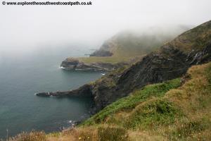
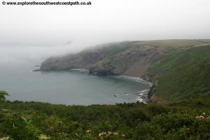
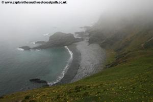
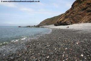
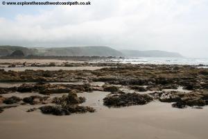
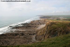
Cross the stream via the little footbridge and keep ahead following the path as it climbs on to the cliff top ahead, Castle Point. On reaching the top follow the coast path ahead as it turns to the right following the cliff top with the sea to your left. You have fine views of the coast ahead here. The path soon enters a field which you keep to the left hand edge of and follow the edge of the field along the cliff top. Pass into the next field and keep to the coast path as it descends again to another stream and little waterfall at Cleave Strand where there is a rocky beach below. Climb back up the other side keeping to the obvious cliff top path. You again follow the left edge of a couple of fields and then descend down again to another stream and waterfall, this time sith a steep descent. Cross the stream via the footbridge and keep to the cliff top path as it climbs steeply back up the other side. As you reach the top you will be pleased to note that this is the last steep ascent for a little while!
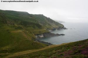
After the steep climb, follow the path along the cliff top along the left hand edge of a field. Cross the field boundary ahead and keep to the coast path with the cliffs to the left. You briefly re-enter the fields ahead passing close to West Dizzard farm to the left. Passing the farm you keep to the cliff top path passing close to East Dizzard Farm also on the right. Pass into the next field and keep to the left edge of the field as you turn right heading south. Shortly after take the path off to the left through the bushes and then turn left back along the field edge path and back to the cliff top. Just before the next corner of the field the path turns left passing the cottage marked as Cancleave on the left. Opposite this is a path down to the beach, but the coast path continues straight ahead along the cliff top with the road close by on the left.
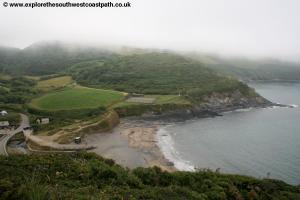
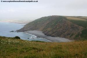
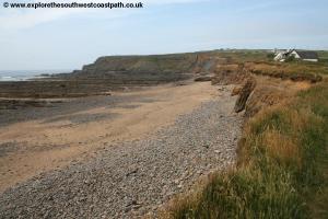
You keep to this cliff top path for around half a mile until it turns right and then comes out onto the road that has been parallel to the path for the last half a mile or so. Follow this road as it twists and turns steeply down to the village of Millook (there is little traffic) and on to the cove of Millook Haven to the left. There is access to the beach here, a pebble beach with a stream behind. Keep to the road initially out of the hamlet as it turns away from the coast and just past the first building on the right turn left on the obvious path up the cliff top, climbing away from the hamlet.
Keep to the obvious path as it rejoins the cliff top for around a quarter of a mile where it rejoins the minor road. Turn left passing a parking lay-by on the left. Just pass this ignore the track off to the right and keep to the road as it descends sharply. Aheadd take the path that runs alongside the road on the left of the road along the cliff top. As you approach the Outdoor Adventure centre the path rejoins the road and you follow it as it turns right. Keep to the road passing a track off to the right. Ignore the first path off to the left leading to a house, but take the one just after this climbing up behind the house and back onto the cliff top path. After you pass the bushes the track splits ahead, take the right most fork here keeping to the cliff top. Now follow the path along the cliff top keeping to the path closes to the cliff top passing the south car park of Widemouth Bay.
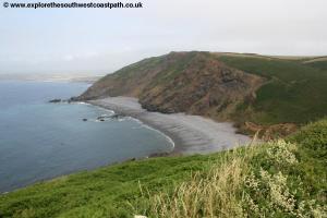
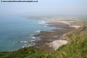
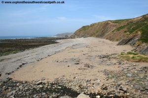
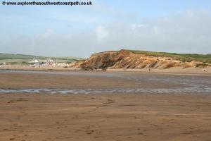
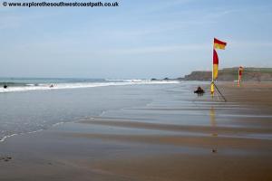
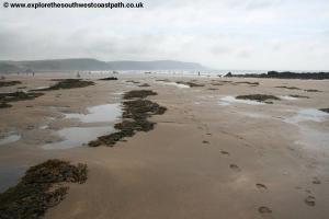
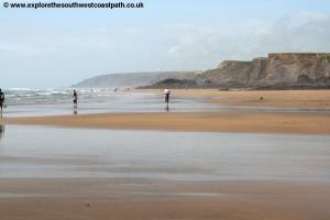
Widemouth Bay is a really lovely sandy beach with sand at all states of the tide and with some sand dunes and low sand-stone cliffs at the back of the beach. The west facing location means the surf is good here and as a consequence it is a very popular surfing beach.
Pass through the car park and take the path north keeping along the top of the low cliffs and sand dunes and admiring this lovely sandy beach. Soon you come to the northern car park. Walk through the large car park and at the end, take the coast path along the cliff top. The path goes behind the Bay View Inn that is right on the cliff top and then returns to the cliff top beyond. At the little headland ahead (Lower Longbeak) you have a choice, either take the cliff top path that rounds the headland or take the shortcut straight on. In either case you soon continue north on the path along the cliff top and close by the road.
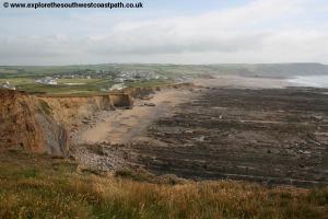
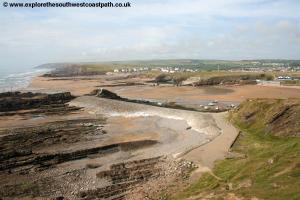
The path now stays on the cliff top just to the left of the road for the next mile or so. As you approach the village of Upton the coast path goes on the coastal side of all the buildings keeping to the cliff top. North of there the path passes through several farm fields but always keep to the obvious coast path close by the cliff top. Soon you come to Compass Point where the is a tower and a compass. From here you have fine views over the beautiful beach at Bude right ahead of you. Just beyond this tower a path leads down to the beach behind the breakwater, but this is only accessible at low tide.
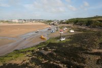
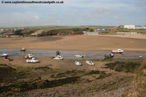
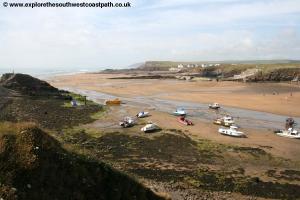
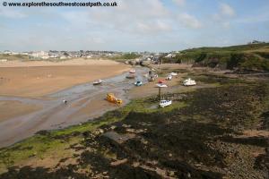
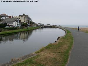
Round the corner and a wide track also descends down to the beach the other side of this stone wall, but the coast path keeps to the surfaced path along the cliff top. Keep to this until it joins the road, Breakwater Road, and turn left as the road now passes alongside the Bude Canal. This now disused canal was built to transport sand from the nearby beaches inland. Now only the sea lock remains although the canal is still in water for around a mile or so inland. The official route of the coast path is to cross the canal via this lock gate and then down to the beach or along the footpath. However at high tide this is sometimes flooded in which case you need to keep on the path beside the canal to the road bridge a little further inland. The town centre is a short walk away to the east.
Western Greyhound bus service 595 runs around once every two hours back from Bude to Crackington Haven, Monday - Saturday all year and on Sundays only in the summer. For details, see the link below. The bus departs from The Strand, adjacent to the canal and just along from the access road to the main Summerleaze Beach car park.
Here are some photos of the walk. Click each picture for a larger version and description.
 |
 |
 |
 |
 |
 |
 |
 |
 |
 |
 |
 |
 |
 |
 |
 |
 |
 |
 |
 |
 |
 |
 |
 |
 |
 |
Ordnance Survey Explorer map 111 covers this area of the coast path and is available from most book shops nationwide and many local shops including the tourist information centre in Bude.
Streetmap is a web site which provides maps of the UK, including the area between Bude and Crackington Haven. The links below cover the coast between Bude and Crackington Haven.