|
|
|
| Distance : 5 miles | Grading : ++ | OS Sheet : 180 |
This walk takes in two superb blue flag beaches. Starting in the popular resort of Woolacombe, you can choose to walk along the sandy beach or on the sand dunes and cliffs behind for around two miles as far as Putsborough Sands at the other end of Woolacombe Sands. After Putsborough, the coast path rounds the headland of Baggy Point, giving good views around the coast. Croyde Bay is just past Baggy Point, and is another excellent beach. The village of Croyde is also picturesque, with several thatched cottages.
Woolacombe is on the B3343 which joins the main A361 through North Devon. It is easily accessible from Ilfracombe and Barnstaple. There is a large car park near the beach. It does get busy in summer but there is an overflow car park further back, so you shouldn't have a problem parking.
By public transport, bus service 303 runs 6 times a day between Barnstaple and Woolacombe (4 times on a Saturday). Bus service 31 runs every hour from Ilfracombe to Woolacombe (Monday - Saturday only). For more information on these services see the link below.
Woolacombe has a reasonable range of accommodation, particularly self catering, and there is a summer only tourist information centre in the town, which has a full list of local accommodation. The choice of accommodation is limited in Croyde, but the links below should help.
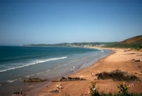
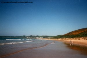
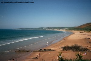
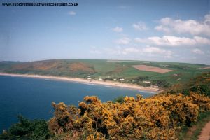
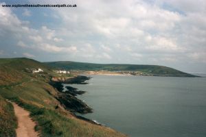
The walk starts in the small town of Woolacombe. Woolacombe has a few shops and pubs, but the main attraction is the superb sandy beach. The beach holds a Blue Flag, so the beach and water are very clean. The west-facing location of the beach means it gets quite a surf so it's not very safe for swimming but is very popular with surfers. The beach is around two miles long, so even in the summer, it's always possible to find part of the beach that isn't too crowded. The official coast path runs behind the beach, but it is also possible to walk the length of the beach, to Putsborough, around two miles away. I chose to walk along the beach, but the coast path follows the road for a short while, before going off into the dunes and then onto the cliffs as you head south.
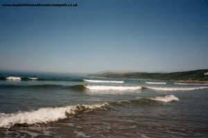
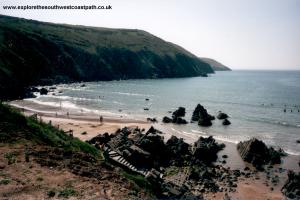
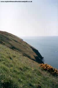
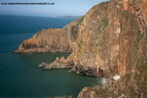
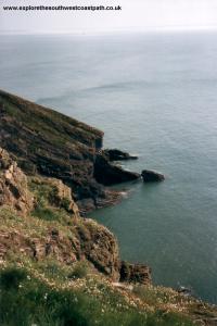
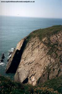
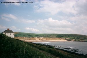
If you walk along the beach, the coast path can be joined at Putsborough Sands, where there are steps up from the beach. It is then a fairly gentle walk out onto Baggy Point, with excellent views of the beach and back towards Woolacombe and Morte Point. There are some quite spectacular rock formations around Baggy Point - there were some people climbing the rocks when I was there.
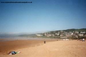
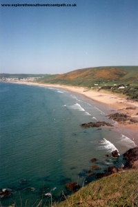
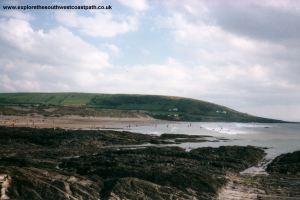
As you round the headland, Croyde Bay comes into view. Once round the headland it is a fairly gentle walk into Croyde. Croyde Bay also has a blue flag and is another excellent beach. As it's smaller than Woolacombe it does get very crowded, and the surf can be bigger here than at Woolacombe. There are dunes at the back of the beach.
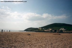
Croyde Village is also a pretty place with several thatched cottages. It has a pub and a few shops. Buses depart from the village, near the pub.
There is only one bus a day on weekdays from Woolacombe to Croyde. There is also a bus that goes from Croyde to Saunton, Braunton and Barnstaple and runs hourly, Mondays to Saturdays and every two hours on Sundays. I chose to start from Barnstaple and travel to Ilfracombe then onto Woolacombe by Bus, returning to Barnstaple from Croyde. This is slow, but as you can buy a day explorer ticket from the driver, it is not too expensive. For more details, see the link below.
Another possibility would be to walk back, since this walk is fairly short (5 miles). Alternatively, a taxi would probably not be too expensive, especially if you can share it.
Here are some photos of the walk. When I arrived at Woolacombe there was a sea mist, but I was fortunate that it cleared within half an hour of my arrival. You can see the mist still on Morte Point on the first photo.
 |
 |
 |
 |
 |
 |
 |
 |
 |
 |
 |
 |
 |
 |
 |
Ordnance Survey Landranger map 180 covers this area of the coast path and is available from most book shops nationwide. It is also stocked at the Barnstaple and Woolacombe Tourist Information Centres.
![]() Multimap is a web site which provides maps of the UK, including around Woolacombe and Croyde. The links below will be of most use to the coast path from Woolacombe to Croyde. These maps join to provide the complete coast path between the two points.
Multimap is a web site which provides maps of the UK, including around Woolacombe and Croyde. The links below will be of most use to the coast path from Woolacombe to Croyde. These maps join to provide the complete coast path between the two points.