|
|
 |
|
|
| < Watchet to Minehead | Lynmouth to Porlock > |
| Distance : 9 miles | Grading : +++ | OS Sheet : OL9 |
![]()
This walk is the first (or last) on the South West Coast Path. It begins in the resort of Minehead with its sandy beach and harbor and soon climbs through woodland into the Exmoor National Park. Here the route follows the heathland and moorland westwards a short distance away from the coast and then descends to the village of Bossington at the eastern end of Porlock Bay. You continue west beside newly-formed salt marshes to finish at the little village of Porlock Weir at the west of Porlock Bay.
Much of the path is across Exmoor. You should be aware that like many moorland areas the weather can be variable and can change quickly so ensure you carry appropriate clothing and wear suitable footwear.
![]()
Minehead is on the A39, the main coastal road through Exmoor. From the M5 motorway if coming south (from the direction of Bristol) exit at junction 23 (Bridgwater) and join the A39 west to Minehead via Williton. From the south exit at junction 25 (Taunton) and take the A358 to Williton where you then join the A39 into Minehead. From the A303, take the A358 to come to the M5 junction 25 where you follow the instructions as above. There are numerous car parks in the centre of Minehead, including pay and display parking spaces all along the sea front.
If you are travelling by public transport The Buses of Somerset route 28 runs every 30 minutes Monday – Saturday and hourly on Sundays from Taunton to Minehad. The bus also serves Taunton railway station. The West Somerset Railway also runs a heritage steam railway to Minehead from Bishops Lydeard which makes a nice way to arrive in Minhead. Bishops Lydeard and Taunton are connected by The Buses of Somerset route 28.
![]()
Minehead is a resort and so has a wide choice of accommodation to suit most budgets. Minehead Hopsitality Association provides a list of guest houses in Minehead. The Northfield Hotel is an independent hotel. The Duke of Wellington is a hotel situated above this bar and pub. Permier Inn also have a hotel in the town. There are also several Campsites in Minehead and nearby.
In Porlock Weir at the end of the walk Millers at the Anchor is a small hotel at Porlock Weir. The Cafe at Porlock Weir provides 5 guest bedrooms. Finally The Ship Inn offers bed and breakfast in ensuite rooms.
![]()
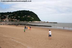
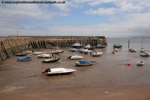
Minehead is the start of the South West Coast Path and is a large and popular resort. It has a sandy beach, becoming rocky to the west of the town and is dominated by the hills to the west of the town. There is the ever-popular Butlins at the eastern end of the bay as well as The West Somerset Railway operating steam and diesel trains.
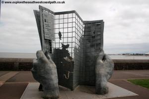
The South West Coast path begins from the western end of the town. Here there is a monument to the coast path, a set of hands gripping a map rising out of the pavement. This marks the official start of the coast path. Confusingly two routes of the South West Coast Path are marked on the pavement here, straight ahead towards the Harbour or to the left. The official route appears to be the path off to the left, so that is described here.
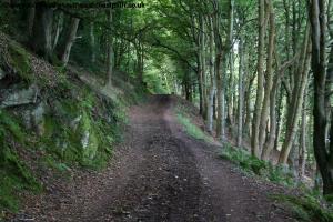
From the marker, turn left and take the path between the houses that rises steeply up steps. Shortly after this point take the path off to the right and follow the zig-zag path that rises steeply up the cliffs through a little garden where some large solar powered lights have been installed. Soon the zig-zag path joins a minor road up from Minehead that you follow, keeping the coast to your right. Continue along the track as it climbs, passing a sign marking the start of the Exmoor National Park.
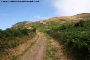
Continue still through woodland and take the higher path each time the track divides and eventually you emerge from the woodland to heathland on the edge of North Hill. From here on the signage is much better. A path joins to the right leading to Burgundy Chapel and you turn left for a short distance (south) and then turn back right (west). Just beyond this point the path splits again and you have a choice of routes.
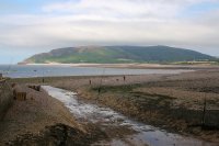
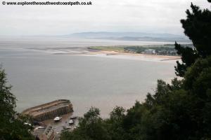
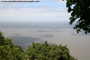
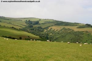
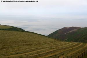
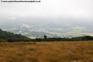
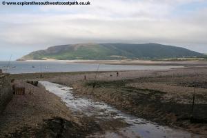
A more demanding route runs closer to the coast, labelled as the Rugged Cliff Top Path. The official route of the coast path however continues west and so this is described here. You pass close to the summit of North Hill to the left (a path leads up), but the coast path continues west on a bridlepath along the southern edge of fields with the road close by to the left. The path is well signed here and you pass very close to Selworth Beacon to the left, a popular view point offering views not only over the coast but south over the hills of beautiful Exmoor to the south. The height gained here can certainly be appreciated, and along the coast on a clear day you can clearly see the coast of South Wales in the distance and Porlock below.
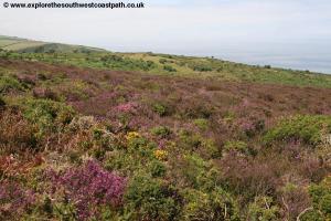
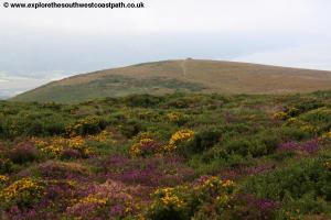
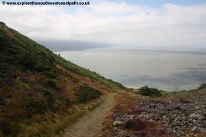
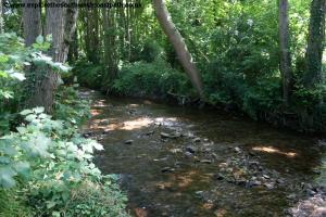
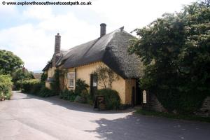
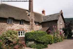
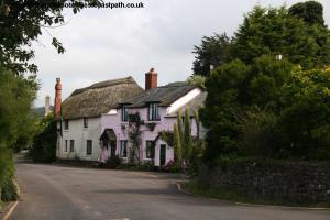
Beyond Selworth Beacon the path turns to head north west with Bossington Hill to the left and heads gradually back to the coast down a dry valley called Hurlstone Combe, a pleasant heather and heathland area. You come close to Hurlstone Point where you have lovely views over Porlock Bay ahead. A small path goes off to the right here to the view point where there is a little tower. You now turn left and descend from the heathland to a woodland path with fields to the right and soon reach a shallow but fast flowing stream which you cross via a bridge into the little village of Bossington with it's thatched cottages and narrow roads.
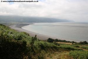
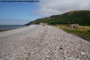
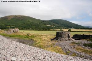
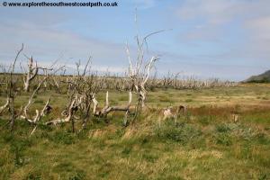
On reaching the road turn right along the road and at the end continue to follow the South West Coast Path signs. The route of the path has changed here. It used to be that you followed the shingle bank of the beach all the way to Porlock Weir. However this Shingle bank was breached a few years ago, causing the sea to flood some of the fields here turning them to salt marsh and killing many of the trees. It is dangerous to attempt to cross the stream that flows out onto the beach so do not be tempted to attempt to cross the beach. Instead keep to the coast path as it takes a winding route along the back edge of the salt marsh close to the village of Porlock to the left. Signs direct you off into Porlock centre if you wish to visit, however the coast path does not actually go into the village.
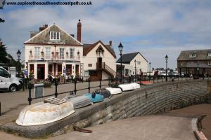
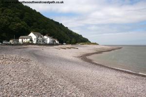
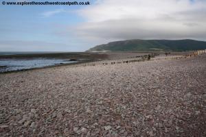
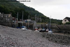
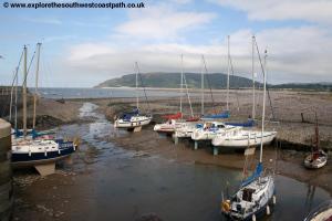
Continue west along the back of the fields and salt marsh and cross the various little streams either via bridges or rocks provided. The path soon turns right back to the coast near West Porlock and from here you walk along the pebbles of the beach to the little village of Porlock Weir. Porlock Weir is an attractive village, with a Quay and dock and many thatched cottages. There are toilets and a pub here should you need refreshment at the end of your walk! From the Quay you have fine views over the wide sweep of Porlock Bay and the hills of Exmoor beyond.
![]()
To return to Minhead from Porlock Weir, The Buses of Somerset route 10 runs 5 times a day Monday – Friday only back to Minehead. There is no public transport to Porlock Weir at weekends.
![]()
Here are some photos taken on this walk. Click each photo for a larger version.
 |
 |
 |
 |
 |
 |
 |
 |
 |
 |
 |
 |
 |
 |
 |
 |
 |
 |
 |
 |
 |
 |
 |
 |
 |
 |
 |
|
![]()
Ordnance Survey Explorer Map OL9 (Exmoor) covers this part of the coast between Watchet and Minehead and is easily available locally. It is also well stocket in book shops nationwide and via online shops.
![]()