|
|
 |
|
|
| < Aust to Severn Tunnel Junction | Pill to Portishead > |
| Distance : 13 miles | Grading : + | OS Sheet : 167 & 154 |
![]()
This walk follows the coast and banks of the Severn as much as possible from the Severn View services on the M48 at Aust south to the River Avon. Most of the walk offers beautiful views over the Severn, although a few miles part of the walk are through an industrial area, which is less pleasant. Near the end of the walk, we cross the M5 motorway and the River Avon to finish in the village of Pill.
![]()
The walk begins from the M48 Severn View services at Aust on the M48 motorway. From the M4 motorway exit at junction 21 from the English side or junction 23 on the Welsh side. The Severn View services are at junction 1 of the M48, the first junction from the M4 from the English side and just after the Severn Bridge if coming from the Welsh side. Note that if you are coming from the Welsh side you will need to pay the toll on the return journey. There is a car park at the services although charges apply after two hours, so you will need to pay to park here.
If you are coming by public transport First Bristol, Bath and West service X7 (Severn Express) runs hourly Monday – Saturday between Bristol and Chepstow with most buses continuing on to Newport. The bus also runs 4 times a day on Sundays, between Bristol and Chepstow only. The bus operates as an express route and so only serves limited stops. It begins from Bristol Bus Station and runs to the The Mall at Cribbs Causeway shopping centre and from there via the Motorway to the Severn View services. Although not listed as a stop in the timetable, the bus will stop here by request, although it will stop on the roundabout, not at the services car park. Take care when negotiating the roundabout to get to the services, as it is not terribly pedestrian friendly. Aust is within the Bristol Outer Zone fare area.
![]()
There is limited accommodation on this walk. There is a Travelodge at the Aust Services at the start of the walk and a Days Inn at the M5 Gordano services, around a mile from Pill. Otherwise there is a plentiful choice of accommodation in the nearby city of Bristol.
![]()
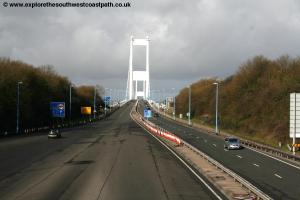
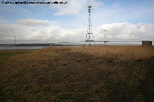
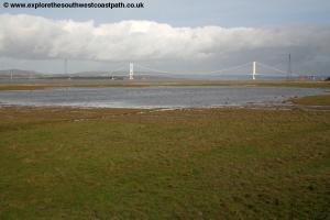
The walk begins from the first Severn crossing, which opened in 1966 and was the main bridge until the Second Severn Crossing was opened in the mid 1990s. Prior to then, the only crossing in the area was a ferry, which we will soon pass. The second bridge is now the main route of the M4 and so this bridge has rather secondary status now and as a result carries a good deal less traffic than it used to.
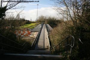
If you arrive by car it is recommended to park at the services car park. If you come by bus, the bus will drop you on the roundabout at junction 1of the M48. If coming from Bristol, follow the edge of the roundabout and cross the on-slip of the M48 with care. Pass under the M48 and continue passing the off-slip of the motorway, which again you need to cross with care. From here a cycle path comes in from the left, unusually however pedestrians are not permitted on this either, so continue ahead on the road into the services, where there is then a tarmac path to the left of the road. You keep left here as close to the motorway as possible until you see the footpath sign on the left, which takes you on a bridge over the top of the toll gates. If you come by car, park in the car park here. From the car park walk along the road to the entrance to the car park . Cross this road and you should see the pavement on the other side of the road. Join this and turn right and follow it to the bridge over the toll booths.
Take this path, which goes right over the toll booths of the M48. Once over the toll booths take the path down and turn to the left. You now follow this path along the Bridge Access Road to come down to a T-junction with passage road. Here turn right and follow the road for around half a mile to the point in turns to the left and heads down hill. As you near the bottom and come towards a large house on the right you should see a track down to the right between the houses. Take this and you are now at the old Aust ferry terminal, which closed in 1966. From here a car ferry used to operate, with room for just 17 cars, until the bridge opened in September 1966. The terminal building and turnstile can still be seen, rusting away, alongside the old slip way.
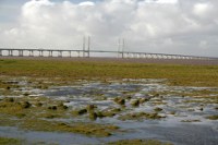
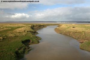
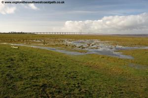
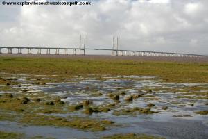
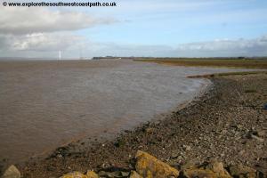
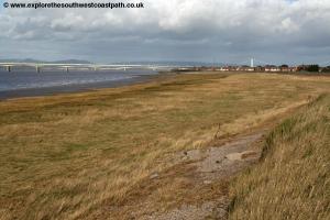
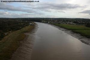
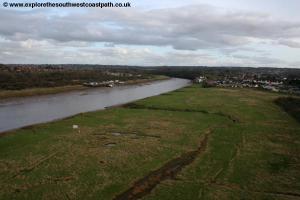
Turn left along this road, with the river to your right and it soon re-joins the road we just left. Continue now along Passage Road. This was once a busy road leading to the ferry prior to the M4, but is now a quiet road with little traffic. Keep to the road and it soon turns a little to the left, away from the river. Here take the path on the grassy bank past the sluice gate on the right. You now continue on this raised bank which soon joins a hedge to the left, which runs parallel to the track. You now keep to this path for around 1.5 miles. There are good views to the two bridges over the Severn, the first Severn crossing behind you and the more recent second Severn crossing ahead. The path is raised over the marshes here and they attract a variety of birds. There are a couple of bird hides on the walk you pass you might wish to visit to view the birds.
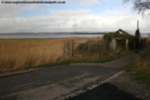
Continue on this track with the Severn on your right until you come to a second sluice gate and the path becomes tarmac. Turn right with the path alongside the stream and back to the banks of the Severn by some houses. Here there is a higher and lower path, keep to the higher path as the lower path is a dead-end. You soon pass a little jetty on the right which marks where there used to be a ferry for rail passengers, before the Severn Tunnel opened. It is interesting to reflect that it was more than 80 years after the Severn tunnel opened that the first road crossing opened, and some distance upstream.
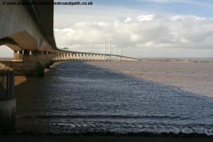
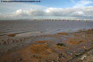
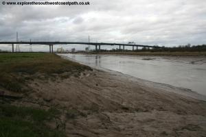
Continue on the raised tarmac path alongside the river to soon pass under the Second Severn crossing, which now carries the M4.This more modern bridge was opened in 1996 to provide increased capacity for traffic. As you pass under the bridge it is worth noting you are also passing more or less above the Severn tunnel, which passes under the river here. Continue south on the tarmac path beside the river, passing some park homes on the left. As you continue you soon come to more housing on the left, now part of the village of Severn Beach. Soon you pass the end of Station Road, which will take you to Severn Beach station if you want to end the walk here (but note, the service is not frequent).
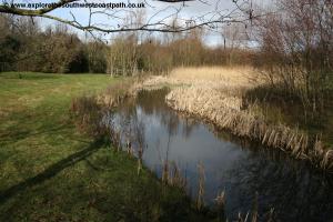
To continue the walk continue south on the river bank path, now taking the lower path which is signed as the Severn Way. You are soon back in countryside but now with the railway running alongside to your left. In places there are paths off to the right, which you may choose to follow for a closer (but mudier) view of the river. Continue until you come to a pipe-line going out to sea. If you have diverted off the main path, head back inland here to re-join the main path. If you are on the main path go over the stil just behind the pipeline and continue on the footpath ahead. This is soon running adjacent to the Severn Beach railway line to the left and as you approach the stream at New Pill Gout, the path turns to the left, to cross the railway line.
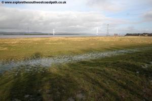
Take care to check for trains before crossing and take care, because unusually no boards are provided over the track here, so you have to step over the rails and the ballast. Once over the path continues to soon emerge onto the A403, where a sign warns of busy traffic ahead and no pavement, although there is in fact a short stretch of pavement on the other side of the road. Here cross the road with care and take the pavement on the other side. This soon heads down away from the road on a combined pavement and cycle path. This goes past a little pond where there is a seat and has Seabank Power Station just inland.
Keep to this main cycle path as it heads away from the road and Severn, goes around the side of the power station and re-joins the A403, a pleasant little bypass of this busy road. The path brings you out to Severn Road just next to the A403. Here cross Severn Road but do not go along it, instead keep straight ahead heading south west along the A403, there is a pavement here. Soon this crosses a stream, Stuppill Rhine. Continue with the main road as it now turns to the right along Smoke Lane. Keep to this main road as it rises to cross over the railway line. Continue to the roundabout with the large Cabot Park signs and go straight on here. The road to the south has a wide pavement and grass verge although it doesn't last, as the pavement soon narrows. Shortly you come to an odd level crossing, odd because although the lights on the road still exist it appears that the railway does not (at least not on the left side of the road). Soon you round the corner and the road ahead is arrow straight and not a particularly appealing sight, running through the Severnside Trading estate. You pass a large Asda distribution centre on the left and continue straight on crossing over the various side roads, some of which have pedestrian crossings. Around mid-way through this industrial area you pass St Andrews Road station which is just off to the right.
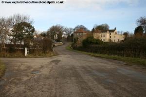
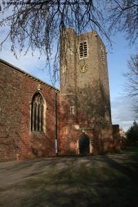
You could end the walk here if youv'e had enough but a word of warning is that the trains are not frequent and stop only by request. To continue the walk keep south along the road. Continue to the large roundabout at the south end of the road where the landscape transitions from industrial to residential. Go straight on here along McLaren Road. At the roundabout ahead turn right still on McLaren Road past the church on the left. This is the village of Avonmouth, which despite the proximity of heavy industry still retains something of a village feel.
Follow this road as it curves round to the left, with a park on your left. Take the first road on the right here, Gloucester Road, signed to Avonmouth station. Take the first road on the left, Portview Road passing Avonmouth station on the right. You could also end the walk here as Avonmouth station has a fairly frequent service into Bristol. To continue the walk, keep to this road, Portview Road until you reach the A4 portway dual carriageway which passes under the M5 Avonmouth bridge here. Here at this junction turn right and cross the Portway via the pedestrian crossing. Once over the road turn right and then take the first road on the left, (West Town Road). Take the first road on the left here which heads back to the Portway and under the M5. By an area of waste ground on the right turn right along the path heading for steps you should see at the end leading up onto the M5 bridge. Take this steps to reach the M5 motorway and turn left doubling back to head south west over the M5 Avonmouth bridge. Although the traffic thunders past here, as the motorway is 4 lanes in each direction, you are segregated from the motorway by solid metal barriers. As you continue the bridge climbs soon offering good views over Avonmouth and then the river Avon, far below. Whilst not as spectacular as the Clifton Bridge further up the river, you can still enjoy a fine view below.
As you pass over the Avon the motorway begins to descend gradually back down again and soon the path leads down from the motorway again to a junction of cycle paths below the motorway, with a couple of rather vandalised pieces of artwork. Here go more or less straight on with the area of marsh on your left and an dis-used railway line to your right. Soon you pass under the railway line (this part is used) and follow the path down into Avon Road. Continue down this road and right with the road, then pick up the path along the sea bank to the left, past some flats on the right. On reaching the edge of the Severn turn right on the raised sea bank continuing past the flats on your right. This soon comes to a surfaced path, Marine Parade, which you continue along.
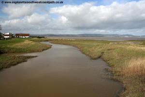
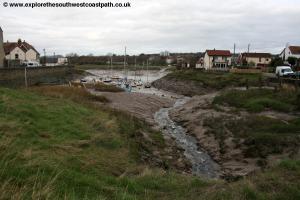
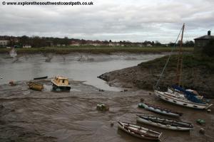
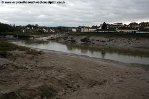
By the flood gate and boat club you could turn left and follow this slipway if the tide is low but be aware that if the tide is high it may be flooded (and even if not, is likely to be muddy as a result of the flooding that does occur). Instead it is recommended to keep to the pavement and then turn left just past this on the path beside the little village green. This brings you back to the promenade which you follow past the Duke of Cornwall pub on the right. Now follow the promenade to the the green with the little muddy stream flowing into the Avon to your left. This is the centre of Pill and there are a few seats on the grass from which you can enjoy the view. You can also see the railway viaduct at the end of this green. This line was re-opened for freight purposes a few years ago, but sadly not passengers, so to get back to Bristol we need to take a bus. To get to the bus stop continue on the road beside the green on your left. Pass under the railway viaduct and along Bank Place. At the end fork right into Pill Street to go past the bollards and onto the main road, Heywood Road. Here turn left and you should reach the bus stop, where the walk ends.
![]()
To get back to the start of the walk, take bus service X4 to Bristol Bus Station, this runs twice per hour Monday – Saturday and hourly on Sundays. From Bristol bus station take bus service X7 back to Aust. This will stop on the roundabout at the junction for the Aust Services (it does not go into the services itself). This bus runs hourly Monday – Saturday and once every two hours on Sundays. Both buses are operated by First Bristol, Bath and West.
![]()
Here are some photos taken on this walk. Click each photo for a larger version and description.
 |
 |
 |
 |
 |
 |
 |
 |
 |
 |
 |
 |
 |
 |
 |
 |
 |
 |
 |
 |
 |
 |
 |
 |
 |
|
![]()
Ordnance Survey Explorer 154 (Bristol West & Portishead) covers this part of the coast. This map is available from local book shops, tourist information centres and online retailers. In addition the links below show the map of this area.
![]()