|
|
 |
|
|
| < Combwich to Pawlett | Stogursey to Watchet > |
| Distance : 13 miles | Grading : ++ | OS Sheet : |
![]()
This walk is a walk of two halves. The first is along the West Somerset Coast path to it’s end at the mouth of the River Parrett and the second part of the walk is along the River Parrett trail beside this river to the village of Combwich. It is worth noting that works is underway to create a new area of marsh on the river Parrett so the paths here are likely to be disrupted.
![]()
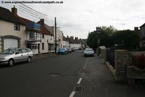
The walk begins from the village of Stogursey. This is easily reached from the A39, the main road through this part of Somerset. From the M5 motorway exit at junction 24 and join the A38 for Bridgwater. Continue through the edge of Bridgewater to the dual carriageway where you turn left and then follow the signs for A39 Minehead until you leave the town. Continue along the A39 to the junction for Nether Stowey. Here turn right on the road signed for Stogursey, which is narrow in places. At the end of this road turn right for the centre of the village. There is space for a few cars to park by the church just to the east of the village or on-street parking along the High Street in the centre of the village.
Note that there is just one bus a day which runs on weekdays during college times only from Combwich back to Stogursey so you need to aim to catch this bus back or you will need to call a taxi (see Getting Back further down).
Sadly there is no longer a regular bus to either Combwich or Stogursey after the local operator Webberbus went bust. This means it is not possible to do this walk entirely using public transport unless you stay in Stogursey.
![]()
In Stogursey the only accommodation is the The Acland Hotel Apartments which is primarily targeted at workers at Hinkley Point and as such you typically have to book for a whole week or a long weekend, there is no nightly rate. If you prefer you could stay in Combwich where the The Anchor Inn, Combwich provides accommodation. Otherwise there is a good choice of accommodation in Bridgwater which is close by.
![]()
Stogursey is an attractive village and peaceful village. Just on the edge of the village is the remains of a castle. Although not open to the public, a footpath passes the castle, which is still surrounded by a moat with the ruins of the castle walls around it. Unusually a thatched cottage (now a private house) has been built in what was the entrance to the castle. If you wish to see the castle, head south along Castle Street and then take the raised footpath off to the right which passes the eastern side of the castle. Please do not trespass on the property of the private house here though.
To begin the walk head north on Lime Street. This is opposite the war memorial in the centre of the village. Soon the houses on the right end and the road narrows. Continue on the road as you pass the last of the houses and the speed limits becomes 60mph and the road becomes Shurton Lane. Soon you pass a farm on the left of the road. Around 100 metres after the last of the farm buildings you come to a track leading into a field to the right by a couple of field gates. Take the stile to the left of this and follow the footpath along the north edge of the field, with the hedge on your left. At the end of this field go through a gap in the hedge to continue in the next field ahead, this time with the field edge on your right, so now on the north side of the hedge. Continue along this for around 100 metres and then turn left, before the end of the field, and head north parallel to the field edge on your right. Cross via the stile into the next field and maintain the same direction to shortly cross into a third field via another stile.
You now turn slightly to the right and follow the path over this field again parallel to the field edges to the road at Newnham Bridge. Follow this road to a tight left hand bend which you take with some houses on the left. After passing the first house look out for a footpath on the right through a metal gate, which you take. Head straight across the field to the row of trees ahead. Keep ahead here to soon cross a little stream and emerge into a large field, where you continue on the path along the east side of the field, with the hedge on your right.
At the time of writing this footpath has been diverted because of expected work on a new power station at Hinkley Point. As this is likely to take some years it is going to be a long diversion! So here you continue north along the field until signed on the temporary diversion to the right. This heads due east directly across the field and into the next field. Here you pass close to the back of the house called Doggets on the map. This brings you to a minor road, Wick Moor Drove although it is likely to become busy when work on the power station begins. Here there is a temporary path along the edge of the field parallel to the road.
Follow this north to the gate when you come out onto the road. Here turn left heading north along the road. The road soon turns slightly to the right and you soon pass a lay-by on the right. Shortly after this, there is a wide path off to the right leaving the road, which you take. This follows the hedge on your left along an area called North Moor, which is open access land. Continue as you soon have woodland on your left. You soon reach the power lines and by the first pylon turn right with the path passing under more power lines along the good path with the sewage works out of sight to the left. Once round the sewage works you come to a junction of paths and turn left passing a pond on the left. Follow this path north with the boundary of the power station and woodland on your left. The path soon turns half to the right to head NE and then finally reaches the coast.
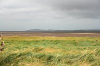
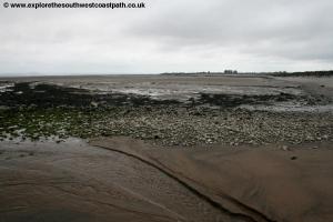
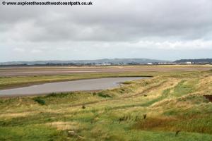
The Severn here is wide and has a huge tidal range, at low tide you might struggle to see the sea. The beach here is a mixture of rock and pebbles. From here on things get easier as we are now following the well signed West Somerset Coast Path. Turn right here on the good path behind the stone sea wall. This path soon turns a little to the right to reach a track parallel to the sea wall, where you turn left and follow this wide track adjacent to the sea wall. After around half a mile you come to a break in the sea wall where there is an outfall pipe and some groynes.
Continue on the wide track along the coast here to pass Stolford Farm on your right. At the farm, where the path forks, take the left (most coastal) of the paths. We are now on Catsford Common another area of open access land. At the track ahead keep left on the most coastal of the paths. You pass a ditch on the right and shortly after this the path turns to the right a little back from the coast. You now follow this although if you prefer it is possible, although harder work, to walk along the shingle bank which re-joins the main path ahead. Whichever you choose the path soon goes alongside a long thin channel full of water on the right. You continue on the wide track parallel to this, heading east. You now head east on this wide gravel track for around 1 mile keeping close to the coast and crossing Wall Common.
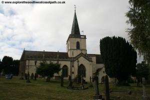
You should emerge into a little car park. Here you continue ahead on the now minor road leading to Steart. There is not much traffic usually so this shouldn’t be a problem. Continue passing another small parking area on the left and soon after passing Brufords and Church Farm where there is the little church to the right. Continue on this road as it passes Quantock View Farm and then turns to the right. Around 100 metres further along you come to a small car park marked as Natural England, Bridgewater Bay and also the start of the West Somerset Coast path.
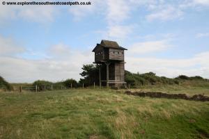
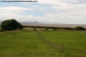
Here there is an optional diversion to Stert Point which is mostly a circular walk on footpaths and permissive paths which brings you back to this same point, so you may prefer to skip it if you are pressed for time or energy! However the diversion does offer the chance to visit some bird hides and enjoy the views of wildlife and the coast from them. To take the optional diversion, continue along the road passing Dobwells Farm and Collards Farm and finally Manor Farm. Continue past the farm where you come to a gate in the road. Take the gate next to this to continue the walk along this track. The track forks right after around 300 metres, which you take. Around 100 metres after this you fork left on the River Parrett trail still. This soon ends at a bird hide, which is the end of the River Parrett Trail. Here the bird hides and nature reserve are normally accessible however so continue on the path to the tower bird hide you can see ahead. This is open to the public and you can climb to the top and enjoy the wonderful views from the top over Bridgwater Bay and Burnham-on-Sea in the distance over the River Parrett. There is another bird hide even closer to the coast which you can reach by following the path beyond the tower hide to reach the most distant hide, closest to the coast. This offers good views over the River Parrett and Bridgwater Bay and to Burnham-on-Sea ahead.
When you have finished enjoying the view, re-trace your steps to the tower hide and at the other end of the field where the track joins, this time turn right and then on reaching the river’s edge turn left, there is a permissive path along the water’s edge. You follow this for nearly 1km where you turn left away from the coast and back to the track that ends at the car park which also marks the end of the West Somerset Coast Path.
Come out of the car park and turn left. Take the next road on the right, more a gravel track. It is worth noting that there is work taking place here to flood some of the land here and turn it into a new area of salt marsh, to compensate for land lost
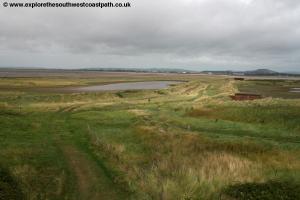
The route signed was to divert west off this track after the first field on the left. From here head south east over the next field to the far corner and into the next field. Here keep to the left hand edge of the field until the path reaches the sea wall beside the estuary. You now follow this estuary edge river bank heading south and then soon west with the river.
Soon this picks up the route of the River Parrett Trail as marked on the map once more. This goes the landward side of a large pond and then turns to head south west with the river along the wide track beside the river. Soon you reach North Clyce (a local word meaning sluice gates). Continue south here passing a pylon on the right and under the power lines. You soon come to Combwich Clyce, nearing the end of the walk. Just south of here you have a choice of routes, the main track turns to the right a little way from the river edge or a footpath continues over a grassy area right beside the river, the latter is recommended.
The grassy path soon meets a road, Riverside, which you continue straight on along, heading due south. You soon pass a small car park on the left and continue on the road alongside the little stream. As the river ends continue along the road, still Riverside. At the junction go straight ahead into Brookside Road. You soon pass the shop and post office on the right and continue along this road to the main road where the walk ends.
![]()
There is just a single bus back from Combwich to Stogursey and this runs only on weekdays during College term times. At the time of writing (January 2017) the bus back departs at 17:38 and arrives back at Stogursey at 17:54. However it is very important to check that the bus is running and still at these times before setting out. If you miss this bus or you are doing the walk on a day when it does not run, you will need to call a taxi. The bus route is The Buses of Somerset route 14.
![]()
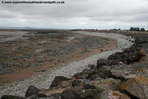
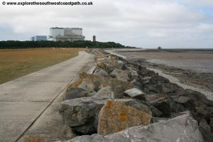
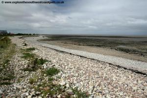
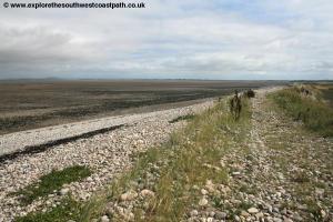
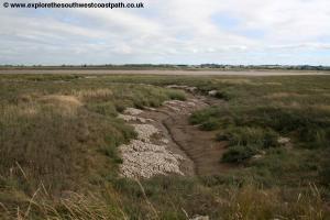
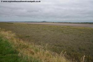
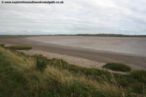
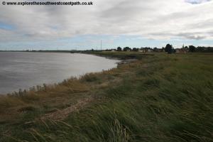
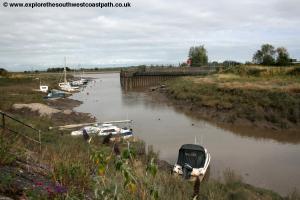
Here are some photos taken on this walk. Click each photo for a larger version.
 |
 |
 |
 |
 |
 |
 |
 |
 |
 |
 |
 |
 |
 |
 |
 |
![]()
Ordnance Survey Explorer 140 covers this part of the coast and is available from bookshops both locally and nationwide as well as internet retailers. The following links also show the maps of the area.
![]()