|
|
 |
|
|
| < Stogursey to Combwich | Watchet to Minehead > |
| Distance : 12 miles | Grading : ++++ | OS Sheet : OL9 & 140 |
![]()
This walk follows the West Somerset Coast path for much of it's length along this attractive and varied coastline. The walk begins from Stogursey and follows an inland route along roads and paths to Hinkley Point where we then head west along the beautiful coastline as it becomes more rugged as we head further west. The walk ends in the pretty town of Watchet. Note that because the West Somerset Coast path runs inland from the coast for part of it's length this walk has some beach walking on rocky and pebble beaches which is hard going and not possible at high tide. Check tide times carefully or follow the main coast path.
![]()
The walk begins from the village of Stogursey. This is easily reached from the A39, the main road through this part of Somerset. From the M5 motorway exit at junction 24 and join the A38 for Bridgwater. Continue through the edge of Bridgewater to the dual carriageway where you turn left and then follow the signs for A39 Minehead until you leave the town. Continue along the A39 to the junction for Nether Stowey. Here turn right on the road signed for Stogursey, which is narrow in places. At the end of this road turn right for the centre of the village. There is space for a few cars to park by the church just to the east of the village or on-street parking along the High Street in the centre of the village. However be aware of the very limited (and time consuming) public transport links back to Stogursey as the regular direct bus no longer runs and there is just one bus. See Getting Back for details.
Unfortunately there is now only a single bus a day, on weekdays during college term only, which serves Stogursey which makes public transport for this walk very difficult. It is not possible to do this walk entirely by public transport unless you are staying in Stogursey or you call a taxi. The Buses of Somerset route 14 runs once per day between Bridgwater and Stogursey on weekdays during college term only.
![]()
In Stogursey the only accommodation is the The Acland Hotel Apartments which is primarily targeted at workers at Hinkley Point and as such you typically have to book for a whole week or a long weekend, there is no nightly rate. If you prefer to stay in Watchet, there is a fairly limited choice of accommodation there. The Mariner, Watchet is a guest house in Watchet and offers 5 rooms. The Georgian House, Watchet is a distinctive guest house in the centre of Watchet. Visit Watchet Accommodation is a list of accommodation in Watchet. There is a much wider choice of accommodation available in nearby towns such as Minehead or Bridgwater. There is also quite a lot of camping and caravan accommodation in the area.
![]()
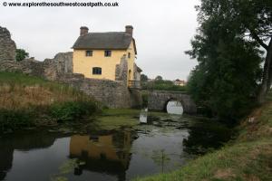
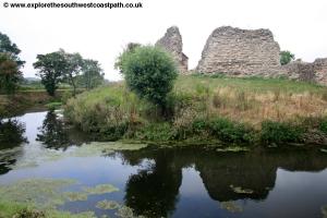
Stogursey is an attractive village and peaceful village. Just on the edge of the village is the remains of a castle. Although not open to the public, a footpath passes the castle, which is still surrounded by a moat with the ruins of the castle walls around it. Unusually a thatched cottage (now a private house) has been built in what was the entrance to the castle. If you wish to see the castle, head south along Castle Street and then take the raised footpath off to the right which passes the eastern side of the castle. Please do not trespass on the property of the private house here though.
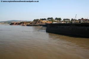
To begin the walk head north on Lime Street. This is opposite the war memorial in the centre of the village. Soon the houses on the right end and the road narrows. Continue on the road as you pass the last of the houses and the speed limits becomes 60mph and the road becomes Shurton Lane. You follow this for around half a mile as the road turns right and then left and you pass a couple of small fords (there are footbridges over). On reaching the main road, turn right and then after about 50 metres turn left on the track just beside the first house ahead on the left. This is a grassy and rather overgrown track between hedges. You continue north over a ford where the path can be boggy. Continue on this grassy track between hedges until the hedges end and a track joins you from the right. Here you continue north with a building just to the right initially, now heading gently up hill. To the right you will have the large fences of the Hinkley Point power station. At the junction of tracks ahead, you keep straight ahead along a track with the high fence on your right. Here the route of the path on the ground differs from the map, follow the diverted path sign north here over fields straight ahead until you can reach the coast. This is likely to continue for some time due to construction of a new power station here.
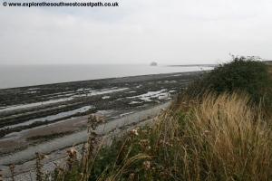
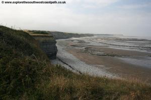
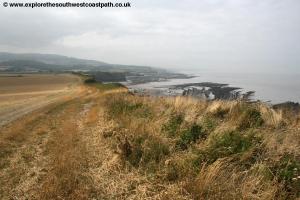
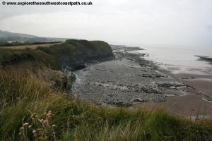
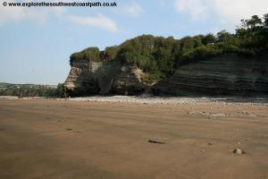
You have the sea wall on the right which leads to the power station where the fence blocks the path, which is closed during the construction at the power station. Here you turn left along the path along the low cliffs. The geology here is amazing, with rocky lines going out from the base of the cliffs out into the bay. You follow this path for around a mile where you then continue ahead on the path now on the landward side of some trees. This crosses a stream at a little area marked as a tidal pond where you return to the cliff top. This continues along the path over the low cliffs along the edge of the field to the tower at Listock, hidden behind high barbed wire fences. This is marked as a Range Quadrant Hut on the Ordnance Survey map.
You now keep to this wide cliff top path (marked as a Gallop on the Ordnance Survey map) for around a mile as the coast becomes increasingly hilly and spectacular as we approach Exmoor. Soon you come to Kilve Pill where there is a small car park just inland from the path. Here you can descend to the beach. Here there is a choice. The official coast path heads inland here, although there is a permissive path along the cliff top for around another 500 metres. The inland route is to take this permissive path to Davids Way where it heads inland to an area marked as Mound on the map. Here turn right on the footpath to Perry Farm and and then the A39. Cross the A39 and take the path up to Perry Combe Plantations where the official coast path turns west.
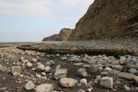
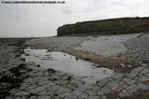
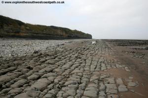
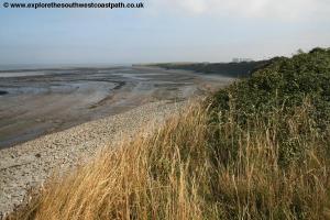
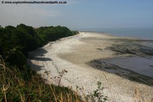
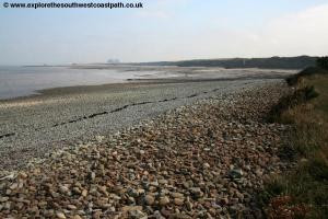
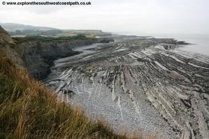
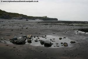
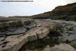
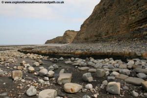
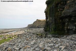
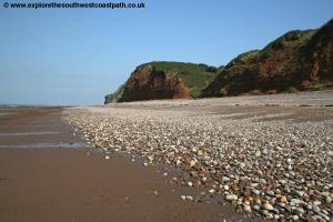
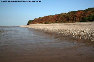
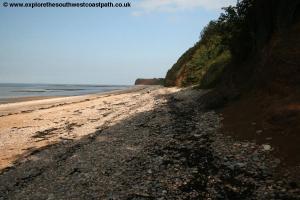
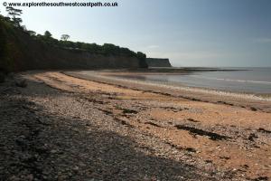
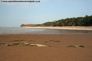
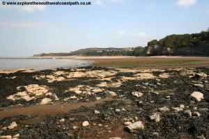
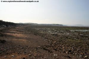
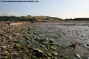
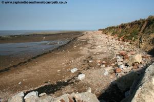
An alternative route is however possible along the beach but it is very awkward, as you will be walking over rocks, boulders and pebbles making for hard walking and many of the rocks are very slippery, so great care is needed. In addition this route is NOT safe at or near high tide. If the tide is coming in or you are not sure of the tide, do not attempt this walk as the tide comes in quickly and there is the risk of getting cut off. If all that hasn't put you off, descend down to the beach and then walk west along the beach, with the sea to your right. The beach is very rocky and it is best to keep close to the cliffs but also best not to walk directly under the cliffs, in case of cliff falls. There are a few small waterfalls in places which make for a particularly beautiful walk and you are also quite likely to see some fossils in the rocks. Rounding the headland of Blue Ben the beach widens to come to St Audries Bay. This is a beautiful beach backed with the red sandstone more associated with the coast of South Devon and soon gives way to sand if the tide is out (although care is needed as it can be muddy in places). Note that the couple of flights of steps leading up from the beach here are private and lead to St Audries Bay holiday park.
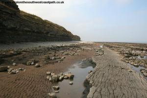
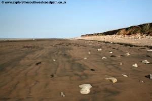
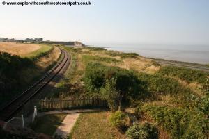
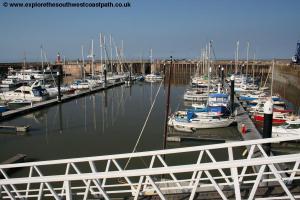
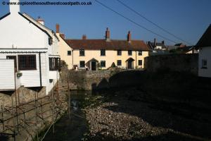
Continue along the beach as it soon becomes rocky again and you round the little headland which has another larger waterfall. Continue round the base of the cliffs passing another large holiday park on the left. The cliffs get lower and soon you come to a pipe line with water flowing out of it. Cross this with care, you will have to try to find a route over the stones and pebbles on the beach that doesn't get you too wet, or take your shoes and socks off if the weather is good. Once over the pipe continue along the beach for another 400 metres or so until you see a slipway with some buildings beyond. Take this slipway passing through a small car park and along it's access track to the road. Here turn right along the road, taking great care as the road is busy and lacks a pavement. You soon pass Doniford Beach Halt on the left hand side, a station on the West Somerset Railway. The road passes over the railway line and you continue as soon the houses of Watchet start and the road gains a pavement. Continue on this road soon with houses on both sides. Pass Govers Lane on the right and Liddymore Road on the left and then the road turns sharply to the right. Keep to the road here to soon reach Watchet station. The walk ends here although if you wish to get to the coast at Watchet, cross the railway line and turn right along Harbour Ride, beside the car park to reach the marina at the end of the road.
![]()
Unfortunately, to get back to Stogursey by public transport is difficult, expensive and time consuming so you may prefer to take a taxi. However if you wish to return by public transport, be aware that this is only possible on weekdays during Bridgwater college term time only and that you should verify all the times below before setting out, which are correct at the time of writing (January 2017). From Watchet take The Buses of Somerset route 28 at 15:07 from Watchet (West Somerset Railway station) to Taunton Railway station, arriving 15:54. From Taunton Station take the Great Western Railway train to Bridgwater which depart at 16:07 and arrives at Bridgwater at 16:18. From Bridgewater station walk to Bridgwater bus station, which is in the town centre. This should take about 15 minutes. From Bridgwater bus station depart at 17:05 on The Buses of Somerset route 14 which arrives back at Stogursey at 17:54 almost 3 hours after you set off!
![]()
Here are some photos of the walk. Click each photo for a larger version.
 |
 |
 |
 |
 |
 |
 |
 |
 |
 |
 |
 |
 |
 |
 |
 |
 |
 |
 |
 |
 |
 |
 |
 |
 |
 |
 |
 |
 |
 |
 |
 |
 |
 |
![]()
Ordnance Surcey Explorer map 140 (Quantock Hills and Bridgwater) and Explorer OL9 (Exmoor) cover the coast in this area and are available from local bookshops, nationwide bookshops and internet retailers. The links below also provide a map of this part of the coast.
![]()