|
|
 |
|
|
| Distance : 8 miles | Grading : ++ | OS Sheet : OL20 |
![]()
Whilst this walk is not part of the coast path it is a useful diversion route if the ferry across the Avon is not running and is also a very rewarding walk in its own right with wonderful views over the river and its estuary. The walk does however require careful planning if you intend to return to your start point, to ensure you connect with the ferry and part of it is also on a tidal road (that floods at high tide) so will be impassable at high tide.
![]()
If you are coming by car it is suggested to either park at Bantham, take the ferry over to Bigbury-on-Sea and then walk back or to park at Bigbury-on-Sea, take the ferry to Bantham and then walk back to Bigbury-on-Sea. Neither place are the easiest to get to, but it is worth making the effort. To reach Bigbury-on-Sea leave the A38 Devon Expressway onto the A3121. Keep to this to it’s junction with the A379 and turn left here for Modbury and Kingsbridge. Keep to this road to it’s junction with the B3392 to Bigbury-on-Sea. Note that although a B-road large parts of the B3392 are single track with passing places. In Bigbury-on-Sea there is a large pay and display car park at the beach overlooking Burgh Island. In addition there is a small free car park (room for around a dozen cars) on the left as you reach the coast. There is also a small “economy car park” at the top of the hill (a field) which is pay on entry in the summer and honest box at off-peak times. If you start instead from Bantham leave the A379 onto the A381 for Salcombe and turn right at the roundabout when signed for Bantham. The road is approximately 3 miles along a single track road with passing places. There is a large pay-on-entry car park at Bantham. Or if you prefer there is a car park at Aveton Gifford at the top of the estuary just off the A381 and you could begin the walk from there.
This is a difficult walk by public transport, but it is possible with careful planning. You will need to ensure that the River Avon ferry is running to do the walk by public transport. This runs only between 10am and 11am and 3pm and 4pm Monday – Saturday during the summer months (generally from late April to mid-September). You will need to start the walk from Aveton Gifford, the most downstream bridge over the river, which is on the path. This is served by First Devon and Cornwall service 93 which runs generally hourly Monday – Saturday from Plymouth to Dartmouth via Kingsbridge and stops in Aveton Gifford. From Aveton Gifford either follow the west or east bank of the river first to either Bigbury-on-Sea or Bantham, cross via the ferry and walk back the other side. As such you will need to time your arrival at the mouth of the river to be when the ferry is running which means either a fairly early start or a late start. The route on the eastern side of the river is shortest, if you are pushed for time. IN addition, the path on the west side of the river is partly on a tidal road which is flooded at high tide, so you will need to avoid high tide too. There is only one bus a week to Bigbury-on-Sea and none to Bantham.
![]()
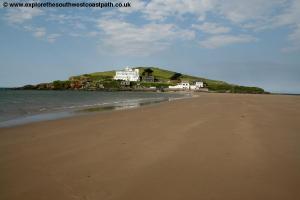
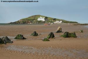
In Bantham, The Sloop Inn, Bantham is passed on the Avon Estuary walk and has 6 en-suite rooms. The nearest hotel for the walk is the Burgh Island Hotel, a luxury hotel situated on Burgh Island just off the coast path at Bigbury-on-Sea. The island can be reached at low tide by walking across the beach or there is a sea tractor at high tide. The hotel is not cheap however, the cheapest room being £400 a night at the time of writing, and you also have to book for two nights if you stay on a Saturday night. A cheaper option is The Henley Hotel which is in Bigbury on Sea. The Royal Oak is a pub in Bigbury (around 1.5 miles north of Bigbury-on-Sea) which has 4 rooms for accommodation. The Summer Winds bed and breakfast is welcoming to walkers and has 3 rooms and be contacted by telephone on 01548 810669. Finally Mount Folly Farm is a campsite on the coast path on the edge of Bigbury-on-Sea.
![]()
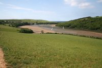
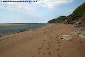
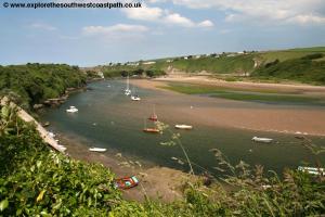
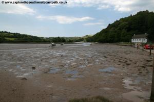
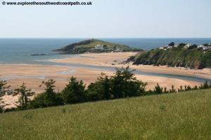
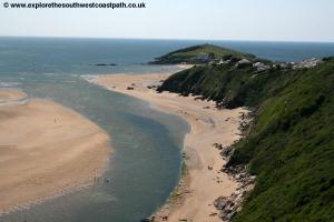
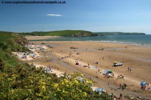
The walk begins from Bigbury-on-Sea. From the main car park in Bigbury-on-Sea there is a choice of routes depending on whether the tide is in or out. At low tide you should be able to walk around on the sand at the base of the cliffs. If the tide is in, from the car park turn left and follow the signed coast path which soon joins the road. A small diversion off the road takes you around Sharpland Point and then back to the road (or you could just keep to the road). Once back at the road continue up hill to the self styled “Economy Car Park†and enter the car park (a field) and continue on a permissive path up the right hand side of the field, parallel to the road. At the gate at the top where this path joins a farm track, turn right to re-join the road. Cross the road and go straight on along a track into a farm yard, with the main barns on the left. Go through the gate into the field and follow the right hand edge of the field. At the south west corner of the field continue on the path ahead, as it descends back down to sea level. Continue on the coast path to Cockleridge Ham where the ferry departs. You should aim to arrive here sometimes between 10am and 11am or 3 and 4pm for the ferry (allow about 45 minutes from Bigbury-on-Sea). If it is low tide you should be able to walk along the beach at the base of the cliffs to Cockleridge Point and re-join the coast path there.
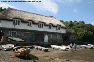
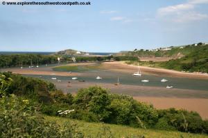
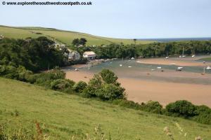
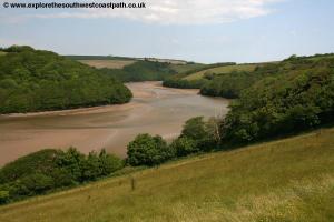
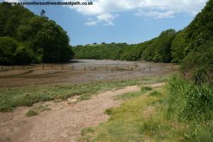
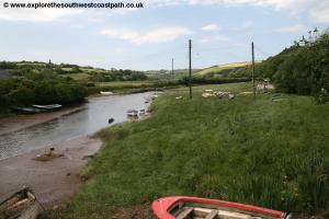
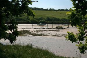
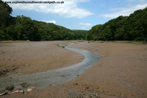
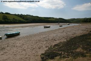
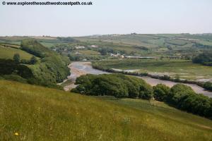
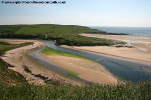
The ferry departs from the beach here although at low tide the ferryman will indicate the best way to approach – the wet and puddled sand requires care to navigate. Once over the ferry you arrive by a lovely thatched boat house in Bantham. Go up the slip way next to it and continue up the road, heading left and following the South West Coast path signs initially. On reaching the road, turn left. If starting from the car park at Bantham, follow the access road to the car park and after passing the gate and hut at the entrance to the car park you pass the road up from the ferry on the left. Continue uphill passing an attractive terrace of thatched cottages and the Sloop Inn. Ignore the turning off on the right but just beyond this and after the house “Gables Endâ€, turn left on the track, signed for “Farm Access Onlyâ€, but also with an Avon Estuary walk sign (showing Aveton Gifford, 3 ½ miles). Follow this track, which runs close to the river on your left passing a single house on the left and the back of some houses on the right. Continue on the track between fields until you pass a small area of trees on the right. Here you fork left, following the Avon Estuary Walk sign to cross a little stream and then join another track leading from the farm at Lower Aunemouth. Turn left here and follow the track as it turns to the right and now follows the right hand edge of the next few fields. You now have wonderful views over the river to your left, a wide sandy estuary. Looking back you have fine views back over to the mouth of the river, Bantham and Burgh Island beyond. You can also see the few houses that make up the hamlet of Hexdown on the other bank of the river.
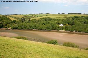
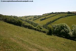
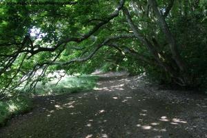
After three large fields the path goes into the woodland of Stiddicombe Wood, a lovely area of woodland. The path through the woodland is obvious and well sign posted and follows close to the right most edge of the woodland. Soon you emerge from the woodland to Stiddicombe Creek, a little creek off the river. The path may be boggy here as it goes round the back of the creek. Once round the creek you turn slightly to the right and head up hill, very steeply, keeping the trees to your left. Cross over a track and continue into the next field ahead, following the signs and keeping to the left hand edge of the next field, still climbing. As you reach a line of trees on the left fork left on the signed path along the field towards a large group of trees ahead. On reaching these turn partly right with the path with the trees on your left. Now follow the track ahead which leads to Stadbury Farm. On reaching the farm turn right and follow the track leading from the farm to the road, heading north east. When this track splits, take the left most fork. This offers good views back over the estuary to your left. The track then descends gradually heading down to South Efford House where it becomes a public road. You pass a row of cottages and then reach the main A379 road. Note that there is a bus stop here which is served by the bus between Plymouth and Dartmouth for those joining the walk by public transport.
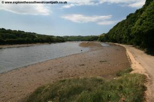
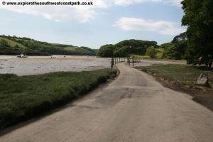
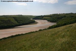
On reaching the main road turn left, taking great care. There is no pavement along the road and it is busy although for much of it’s length, a permissive path has been built alongside the road, to the right of the road which makes things easier and safer. This is primarily after you cross the first bridge and before you come to the second one. On re-joining the road continue ahead to the roundabout. At the roundabout you turn left on the signed tidal road, with a car park on the right. Ignore the entrance to the car park and continue along this tidal road. As previously mentioned this part of the walk is tidal and so will not be passable at high tide. Even at low tide the road is likely to be wet in places from when the tide was in. There is initially a small ford but after that the road is easy to follow. Although there is traffic along the road it is not that busy and other than that is a delight, offering wonderful views of the river and woodland.
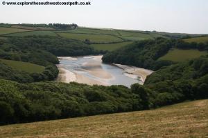
The road is soon wooded on the right with rock faces beyond and then a little creek on the right by the village of Milburn Orchard. Do not take the path off to the right here but continue with the road crossing the mouth of the creek at the ford. Just after this ford, where there is a car park on the right, turn left with the signed Avon Estuary Walk, leaving the road behind.
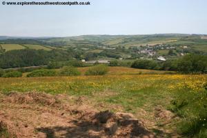
Follow this path to the trees and then turn right with the path just after the trees. Cross into a large field and keep straight ahead, on the higher path which climbs, heading due south west. Cross into the next field and keep ahead on the path near the top of the field. This soon reached the field edge on your right and you continue ahead with the hedge on your right. Pass some trees on the left and then cross into the next field, keeping to the right hand edge of the field and aiming for the next trees ahead. Here follow the path around the edge of the woodland and on leaving the woodland go straight across the field ahead on the obvious path. Just before you reach the road, the B3392 you turn left on a permissive path along the field edge with the road to your right. At the south end of the field you re-join the road and continue south and at the road junction ahead where the main road goes to the right, go straight ahead along a track. This is a pleasant track with grass down the middle which leads to Lincombe. Here you turn left the track now heading due east and descending back towards the river. As you near the river, the track curves to the right which you follow now heading south west and soon reaching Villa Crusoe. Here you fork right on the path climbing back up hill to the hamlet of Hexdown.
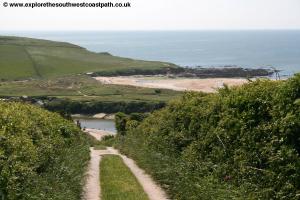
Continue through Hexdown with the row of houses on the right and then follow the road ahead which comes to a junction. Here you turn left and follow the tarmac road through the golf course (Bigbury golf club). The road turns half left and you continue, now heading south east. Keep to the track as it turns sharply right by 90-degrees to head SSW. Past a hole on the left, you turn left on the track off the tarmac road heading SEE. At the line of trees, turn right and keep the line of trees on your left heading due south down hill. On reaching the trees continue ahead to emerge by the ferry point at Bigbury-on-Sea. Here if you parked in Bantham, you can cross back to Bantham. From here you can also turn right and either follow the coast path back to Bigbury-on-Sea on the base of the cliffs if the tide is out.
For the coast path, turn right and follow the path alongside the house to the left and up hill through bushes into a field. Follow the left hand edge of the field as it climbs up hill to the farm (Mount Folly). Follow the farm drive to the road and then cross the road. Go into the field ahead and turn left following the permissive path along the left hand edge of the fields, heading down hill. The south end of this is the economy car park and here you leave the field to the road (where the pavement starts) and turn right along the road to the main beach car park at Bigbury-on-Sea.
The alternative, if the tide is out is to follow the beach around to Bigbury-on-Sea but this is only possible if the tide is out and is rocky in places, so care is needed.
![]()
As previously mentioned, this walk can either be treated as way of crossing the Avon (in which case you don't need to get back) or as a circular walk. In the latter case, the ferry that crosses the Avon is required and this runs only between 10am and 11am and 3pm and 4pm Monday – Saturday during the summer (typically mid April to late September). If the ferry is not running the only alternative is a taxi.
![]()
A photo gallery taken along the walk can be found below. Click each image for a larger version.
 |
 |
 |
 |
 |
 |
 |
 |
 |
 |
 |
 |
 |
 |
 |
 |
 |
 |
 |
 |
 |
 |
 |
 |
 |
 |
 |
 |
 |
 |
 |
 |
![]()
Ordnance Survey Explorer OL20 (South Devon) covers this area and is available from bookshops locally and nationwide as well as on-line retailers. The links below also show the map of the walk.
![]()