|
|
|
|
|
|
| Distance : 10 miles | Grading : +++ | OS Sheet : 202 |
![]()
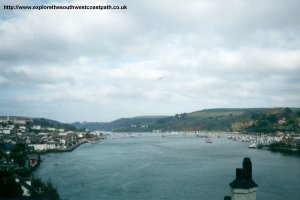
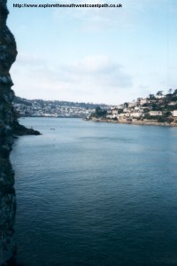
This walk starts in the popular maritime town of Dartmouth on the banks of the river dart. The coast path follows the river through to Dartmouth Castle (which is worth a visit). Once past Dartmouth Castle there is a choice of paths - the coast path which sticks to a low level around the coast, or a bridleway which stays at a high level. After the National Trust car park at Little Dartmouth there is a lot of road walking in Blackpool. There is not a pavement for much of the path and the road is busy, so take care along here. After Blackpool Sands the path soon joins the beach at Slapton Sands. In land is Slapton Ley, an important nature reserve.
![]()
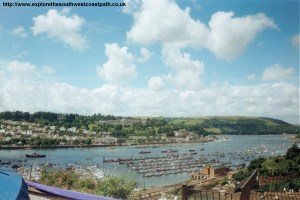
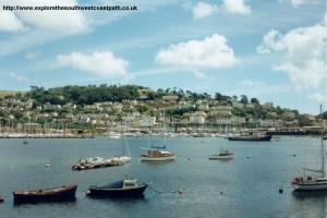
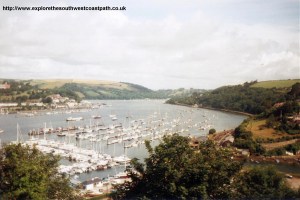
Dartmouth is easily accessed from the A3122, which joins the A381 (the Totnes - Kingsbridge road). Parking is limited in Dartmouth though, so a park and ride scheme runs from the back of the town, which you might have to use in the summer. Alternatively, the A379 runs into Kingswear which is just across the river from Dartmouth. A frequent passenger ferry operates between Kingswear and Dartmouth.
If you're traveling by public transport there is a bus service from Totnes to Dartmouth, and from Kinsbridge. There are also frequent buses to Kingswear, from Brixham (operated by Stagecoach Devon) for the ferry to Dartmouth.
Ferries run from Totnes to Dartmouth, tide and weather permitting which could also be used to get to the walk. The Paignton and Dartmouth Steam railway runs from Easter to the End of October between Paignton and Kingswear, providing a scenic way of getting to Kingswear.
There is a reasonable range of accommodation in Dartmouth and Kingswear. There is a tourist information centre near the harbour in Dartmouth which has a full list of accommodation in the area. There is a limited range of accommodation in Torcross. The links below also give information on accommodation in the area.
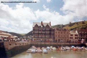
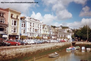
This walk starts at the river side in Dartmouth. If you arrive at Kingswear, take the ferry over the river to Dartmouth. On arrival at Dartmouth the path is a little difficult to follow. As you face the river and Kingswear, turn right and walk along the river side towards where the lower car ferry stops. You need to go slightly in-land here as the road along the coast goes into the small castle at Bayards Cove. The road you want is called Newcomen Road which heads uphill out of the town. This road then becomes Southtown, then splits into two roads, take the road on the left, called Warfleet Road. This road curves round a small bay, then take the first left called Castle Road. There is a footpath raised next to the road through the edge of some woods, or you can stick to the road, as there is little traffic as the road only goes to the castle.
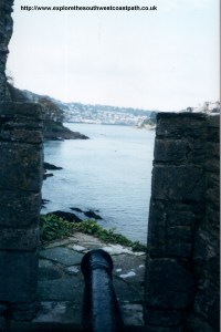
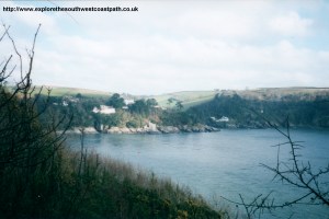
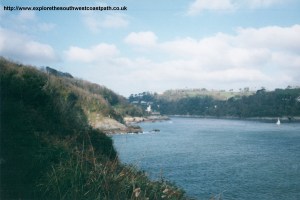
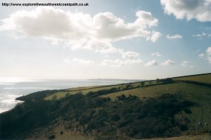
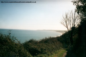
The castle is now owned by English Heritage and is open to the public (in the winter as well as the summer). There is a small shop and cafe here which may be open. The Castle is worth a visit if you have time. There is another castle on the other side of the river at Kingswear, but this is smaller and privately owned. There is a path down to the small beach by the castle, but the coast path goes up the steps to the right, behind the seating area. As you begin to round the coast, you have a choice of paths. There is a lower level path around the coast, which is the official coast path. Alternatively, there is a flatter path, which stays at a higher level, which is the bridleway. Both paths meet at the National Trust car park at Little Dartmouth. The higher path gives a good view around the coast, but the lower path is closer to the sea and so is probably preferable.
There is a car park and some seats at Little Dartmouth. After here the path unfortunately sticks to the busy road into Stoke Fleming. As you come out of the town the road curves, and there is another road which goes towards the coast, but don't follow it as it's a dead end - the path sticks to the main road (shown in yellow on the OS map). Stick to the road through Stoke Fleming. The signage here is very poor, so I'm not sure which is the official route out of Stoke Fleming. I walked next to the main A379, but there is no pavement and the road is busy, so you could try an alternative route round the back, which is obvious on the map. It still means walking on roads, but this road is likely to be quieter.
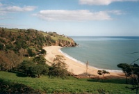
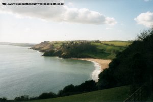
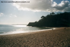
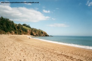
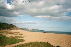
At Blackpool Sands there is pub and cafe and a very good beach (Blue Flag and Seaside Award). The beach is coarse sand and shingle, but is very pretty and clean, so makes a good place to stop. The sea can get quite rough here at times, and the beach is backed by trees, giving a very secluded feel. The Venus Cafe here is open from Easter to the end of October and at weekends during November, February and March. The official route out of Blackpool Sands takes a minor road (again, it is clear on the map), which joins the main A379 again (shown as Landcombe Ho on the map). Stick to this road as you descend to the beach below. The beach here is again coarse sand and shingle, but it clean and long, so is never too crowded. The coast path sticks to the road, or you can walk along at the back of the beach. The main A379 road here was badly damaged in storms in early 2001 and was closed, to be replaced with a temporary single track road. The new road has now re-opened but is only expected to last around five years whilst a more permanent solution is found.
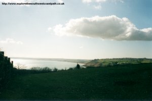
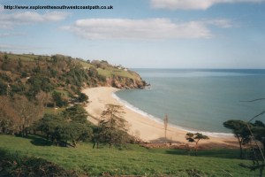
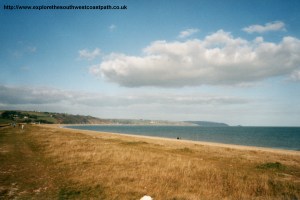
The fresh water lake behind the road at Slapton Ley is an important nature reserve. It stays between the road and the coast path all the way into Torcross. This area has a checkered past. The villages around here were evacuated in 1943, to allow American troops to practice for the D-Day landings on the Normandy Beaches. One casualty of the occupation was the Royal Sands Hotel, which was destroyed - the site is now the middle sands car park. A memorial was erected on the beach by the US government, and a Sherman Tank is also on display at the car park in Torcross as a reminder of the areas recent past.
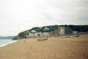
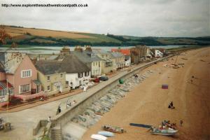
Torcross is a pretty village, with a row of houses backing into the beach and following the road round Slapton Ley. If you're returning by bus to Dartmouth, the bus (number 93) goes from the centre of the village on the main road overlooking Slapton Ley. Note though that it is quite expensive, so if there is more than two of you walking together, you might find it cheaper to get a taxi.
First Western National service 93 runs between Kingsbridge, Stokenham, Torcross, Slapton, Strete, Stoke Fleming and Dartmouth, with some services also starting or ending beyond Kingsbridge to Plymouth.For more information on the service call First Western National on 01209 719988 or Traveline on 0870 608 2 608.
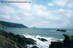
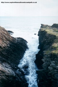
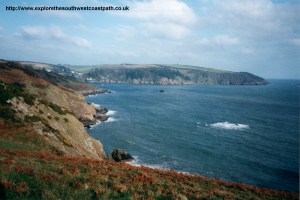
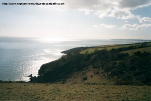
Here are some photos of the walk. Click a picture for a larger version and description.
 |
 |
 |
 |
 |
 |
 |
 |
 |
 |
 |
 |
 |
 |
 |
 |
 |
 |
 |
 |
 |
 |
 |
 |
 |
 |
Ordnance Survey Landranger map 202 covers this area of the coast path and is available from most book shops nationwide. It is also stocked at the tourist information centre in Dartmouth.
![]() Multimap is a web site which provides maps of the UK, including around Dartmouth, Blackpool Sands and Torcross. The links below will be of most use to the coast path from Dartmouth to Torcross. These maps join to provide the complete coast path between the two points.
Multimap is a web site which provides maps of the UK, including around Dartmouth, Blackpool Sands and Torcross. The links below will be of most use to the coast path from Dartmouth to Torcross. These maps join to provide the complete coast path between the two points.