 |
|
|
| Distance : 6 miles | Grading : + | OS Sheet : 126 |
This walk follows the Tarka Trail from Barnstaple, the principal town of North Devon, west along side the river Taw. The walk follows the course of the old Barnstaple to Ilfracombe railway line and offers fine views of the river for much of the walk.
Barnstaple is the principal town of North Devon and has good road links. The A361 links Barnstaple with the M5 junction 27 and Ilfracombe, the A377 links Barnstaple and Exeter and the A39 links west with Bideford and Bude and to the north to Lynton, Lynmouth and Minehead. There are several car parks in the town centre or a park and ride is accessible from the A39 junction just to the south west of the town centre. Note that the centre of Barnstaple can get congested at peak times, but the congestion is no greatly reduced due to the construction of a new bypass and bridge.
By public transport, Barnstaple is the hub of the public transport network with frequent trains to Exeter via Crediton and frequent buses to Ilfracombe, Bideford and Torrington and many other smaller towns and villages nearby. For details see the link below.
There is a good range of accommodation in Barnstaple. There are tourist information centres in both Barnstaple and Braunton, both have lists of all the accommodation in the area. For more information call Barnstaple Tourist Information Centre on 01271 375000 or see the links below.
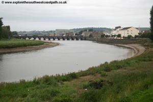
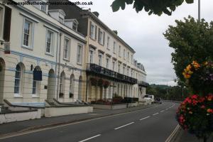
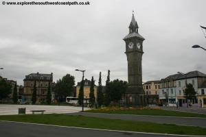
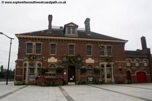
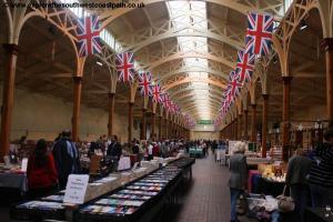
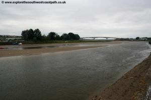
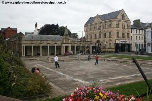
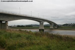
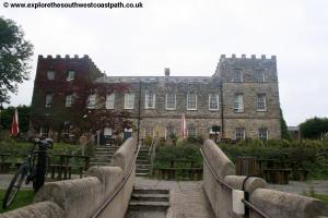
Barnstaple is a busy and attractive market town with a wide variety of shops and a Pannier market. There is also a museum beside the river. The walk begins from the towns bridge that crosses the river Taw. This attractive stone bridge was once the only crossing in the area although a new crossing further down stream has also now been built. From the north side of the bridge (the side of the town centre) turn left along the Strand passing close to the Barnstaple museum. Continue on the old railway line past the former bus station on the right, an attractive building and enjoy the fine views back of the Taw to your left. Soon you cross the River Yeo and the last of the buildings of the town centre to your right. Just beyond this point you pass under the new bridge over the river providing much needed traffic relief to the town, as previously all the roads went through the town centre. Beyond the bridge to the right are sports fields although those soon give way to an industrial estate.
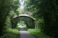
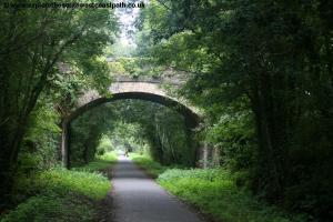
This path follows the former Barnstaple to Ilfracombe railway line that opened in 1874. The line enjoyed direct trains to London carrying large numbers of holiday makers to the resort towns of North Devon. Sadly the line closed as part of the Beeching closures with the last train running in 1970 with the line being lifted in 1975. It was subsequently re-opened as the Tarka Trail which is also the South West Coast Path at this point. It is perhaps a mixed blessing, since the former track bed of the line now provides a fine and very accessible walk and cycle trail, but the frequent congestion on the A361 shows that the railway served a valuable purpose.
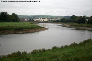
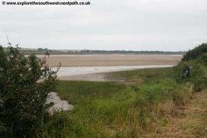
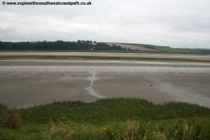
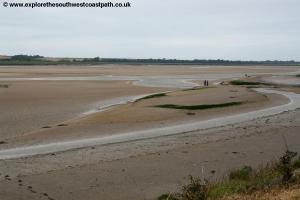
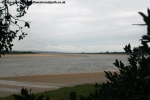
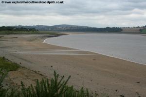
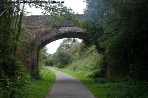
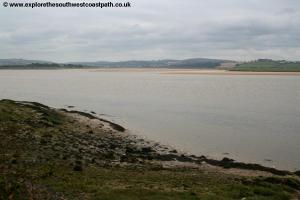
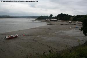
Once past the industrial estate on the right you have fields to the right although the noise of the A361 can be heard for much of the way. To the left the Taw has now widened as it approaches the sea with the town of Fremington now visible on the opposite bank. You continue west beside the river on this pleasant flat path for another couple of miles as the A361 gets closer to the path. You pass under one of the old railway bridges near Ashford. Just beyond here the river turns to the south and you can see the huge sand banks to the left at low tide. Continue west along the path to pass a pub and hotel to the right, a popular stop for walkers and cyclists alike. Just beyond here you come to a little quay where there are a few boats but from here on the Tarka Trail and Coast path leave the banks of the river as the river turns south but the path continues west, passing to the north of the village of Chivenor.
You soon come to a road which you cross and continue on the Tarka Trail. To the left you now pass the Royal Marines and RAF base of Chivenor. There are numerous buildings here as well as several helicopters and aircraft. Continue past the airfield to the left as the path curves to the right and you cross the road to Wrafton on the right. Keep going straight on to join another road. The Tarka trail and coast path turns left here but to head for the centre of Braunton continue on the cycle path ahead between houses to come out into Station Road - a reminder of the paths past! Go straight on and follow the road as it curves right into South Street and there turn left to come to the main road junction with the A361 and the B3231 just beyond where the walk ends.
To return to Barnstaple there are frequent buses from the A361. There are also buses to Ilfracombe and Croyde travelling along this road. For details see the link below.
Here are some photos of the walk. Click each picture for a larger version and description.
 |
 |
 |
 |
 |
 |
 |
 |
 |
 |
 |
 |
 |
 |
 |
 |
 |
 |
 |
Ordnance Survey Explorer map 126 covers this area of the coast path and is available from most book shops nationwide and many local shops as well as the Barnstaple and Braunton tourist information centres.
Streetmap is a web site which provides maps of the UK, including around Barnstaple and Braunton. The links below will be of most use to the coast path from Barnstaple to Braunton. These maps join to provide the complete coast path between the two points.