|
|
|
|
|
|
| Distance : 14 miles | Grading : ++ | OS Sheet : OL15 |
![]()
This walk starts from the beautiful village of Abbotsbury, behind Chesil Beach. The walk goes past the famous Swannery, then climbs onto a high path, inland for a while before dropping down back to sea-level behind The Fleet. The high-level path is difficult to follow at times, so I recommend the more detailed OL15 map for this walk. Once down to the coast, the path continues behind The Fleet, all the way to Ferry Bridge near Weymouth. After Ferry Bridge, the coast path continues along the coast, with good views of Portland, past Nothe Point and Nothe Fort and into the centre of Weymouth.
![]()
Abbotsbury is on the B3157 which runs between Bridport and Weymouth, and is quite a scenic road. There is a car park in Abbotsbury. If you're travelling by public transport, there are buses from Weymouth, running approximately hourly and also buses from West Bay, Bridport and Lyme Regis. For more details on the bus services see the links below.
Abbotsbury is a fairly small place and so accommodation is limited. There is a very large choice of accommodation in Weymouth however, and the tourist information centre on the sea-front should be able to find you accommodation.
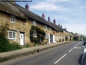
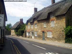
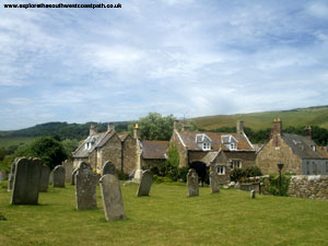
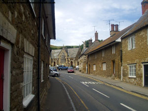
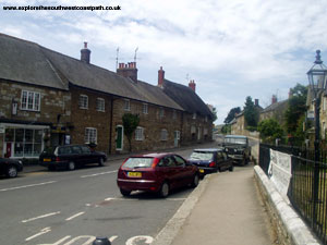
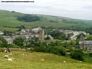
It's worth taking some time to look round Abbotsbury first, as it's a really pretty village. For this walk, I'd advise using the more detailed "Explorer" map, rather than the Landranger map I normally recommend, as parts of this walk are badly signed. From Abbotsbury, the coast path begins to the side of the Post Office, past a small farm. The path approaches St Catherine's Chapel, but doesn't actually go up to it, but it's a worthwhile diversion if you can spare the time. The coast path goes round to the east of the Chapel, across a small stream and then goes past the entrance to the swannery.
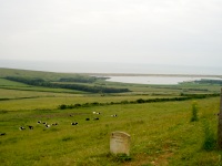
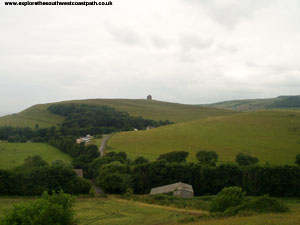
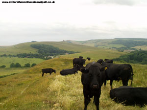
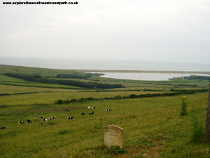
Once past the swannery the path climbs up a hill and then continues at a high-level for quite a while. The path is initially a little difficult to find by the overflow car park, but once you see the first post it's fine. From the top of the hill you get excellent views of the The Fleet below and you can also easily see all the swans at the swannery. You might come across a lot of cows on the path here (as I did), so you might need to be careful where you tread! After a while you have to go through the edge of fields where crops are growing and I found this part of the path was very poorly signed and maintained, being very overgrown in places.
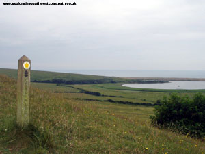
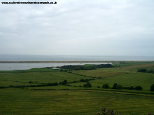
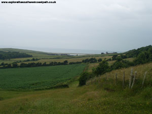
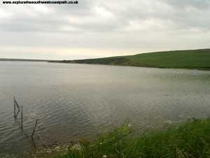
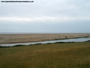
After a while the path comes to an end and there are paths to the left and right (near West Elworth), turn tight here and go down the field, with trees on your right. At the bottom, turn left and the path comes to a minor road, which you need to cross here. I found this part of the path difficult to follow, as there are several gates that come out onto the road, but the correct one does have a coast path sign on the edge of the road. Once across the road the path continues straight on for a while but then turns right near Wyke Wood where it starts to descend back towards the fleet. Continue straight on until you get to the fleet, across several fields (again, a bit overgrown in places). The coast path meets the fleet at Mixen Plantation / Rodden Hive and now follows near to the edge of the fleet all the way to Ferry Bridge, although the height of the shingle means you can't see much of the sea.
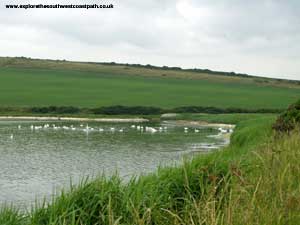
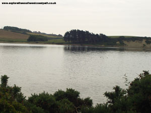
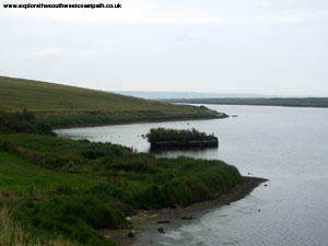
There are no bridges across the fleet to Chesil Beach, so the only way to get across would be by boat. This part of the walk is very peaceful though and there is quite a bit of wildlife to watch. From Rodden Hive, the path heads south to Langton Hive Point, where there is the first of several slipways and also a minor road into Langton Herring. Continue along the coast path and over the footbridge to the next small bay where the path then heads south again, towards Gore Cove and the Moonfleet Manor Hotel. Once past the Hotel the path is fairly straight towards East Fleet, where there is a large caravan park.
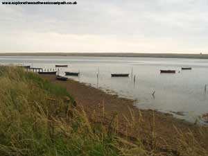
The path climbs a bit away from the Caravan Park round to Chickerell Hive Point at the end of a small bay. At the other end of the bay you have to go down onto the beach briefly before you come towards Tidmoor Point. There is a military firing range on this headland, so if there is firing going on, you need to follow the path inland. If there is no firing, you must still stick to the marked path. Once round the headland you come towards another cove where there is another large caravan park (Littlesea Holiday Park). As you head away past the caravan park you get to the point where the Fleet is at it's most narrow, but then have to head inland past a military establishment, with high barbed-wire fences. At the other side of the military buildings, there is a minor road - the path begins again at the end of the road. This part of the path seems quite popular with dog-walkers and so is quite a bit busier, but there are good views of Portland ahead.
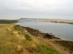
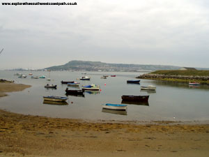
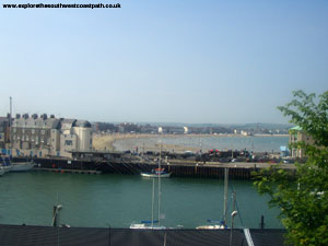
Follow the path all the way round to the end of Chesil Beach, where there is a pub. The next part of the path involves quite a lot of suburban walking, although there is still a lot to see as there are good views over towards Portland, however if you decide not to continue, there is a bus stop here from where there are very regular buses into Weymouth. To continue on the coast path, cross the busy road, then go round past the houses next to the small harbour. The path is signed "The Rodwell Trail" most of the way and follows the route of the old Weymouth to Portland railway line, and so is an easy and flat walk. For part of it, there is a footpath on grass to the right, where you get better views of the coast and Portland Harbour.
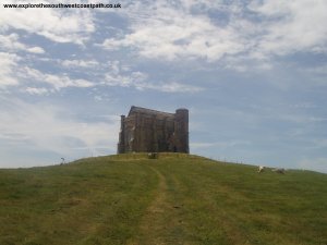
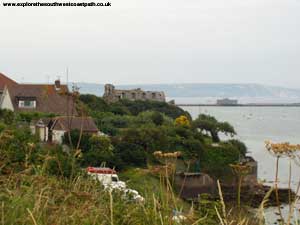
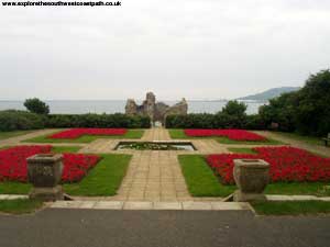
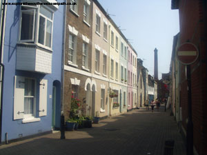
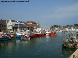
About half-way along this path you come to a pretty park, where there are the remains of Sandsfoot Castle, which dates from 1539. The castle itself is now fenced off, but you can still get a good look round the outside. Stick to the path as far as Castle Cove, but here the Rodwell Trail goes round to the left, but the coast path continues along the residential road. It then goes into Belle Vue Road, a quiet road with some large houses. At the end of the road you come out onto a grassy area at the edge of the Portland Breakwater. At the end of the grassy area, the path goes round Nothe Point, although you might choose to continue straight on where you come out to Weymouth Harbour. The walk round the headland is worthwhile though. Once you get round onto the Weymouth side of the headland there is a ferry crossing the harbour, or you can continue round the harbour where there is a swing-bridge (which seems to lift quite regularly). This takes you into the shopping centre, a short walk from the beach and sea-front.
There are buses from Weymouth back to Abbotsbury. All the buses depart from the Kings Statue, near the Tourist Information Centre on the sea front. There are two different routes (run by different companies), but between them the services run approximately every hour. For more details on the bus services, see the links below.
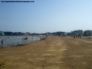
Here are some photos of the walk. Click each picture for a larger version and description.
 |
 |
 |
 |
 |
 |
 |
 |
 |
 |
 |
 |
 |
 |
 |
 |
 |
 |
 |
 |
 |
 |
 |
 |
 |
 |
 |
 |
Ordnance Survey Explorer Map OL15 covers this area of the coast path and is available from most book shops nationwide and also the post office in Abbotsbury and Weymouth Tourist Information Centre at the time of writing.
![]() Multimap is a web site which provides maps of the UK, including around around Abbotsbury and Weymouth. The links below will be of most use to the coast path from Abbotsbury to Weymouth and the maps join to provide the complete coast path between these two points.
Multimap is a web site which provides maps of the UK, including around around Abbotsbury and Weymouth. The links below will be of most use to the coast path from Abbotsbury to Weymouth and the maps join to provide the complete coast path between these two points.