|
|
 |
|
|
| < Uphill to Brean | Combwich to Pawlett > |
| Distance : 14 miles | Grading : ++ | OS Sheet : 153 & 140 |
![]()
This is a walk of two halves, the first following the expansive sandy beaches from Brean south to Berrow and the small resort of Burnham-on-Sea. From Burnham-on-Sea to continue along the coast we must first cross the river Parrett which requires diverting inland to Bridgwater. This walk begins to do that by continuing south into Highbridge, crossing the river Brue and then heading south alongside the river Parrett. This part of the walk follows a path over salt marsh and farmland to end in the quiet village of Pawlett, just north of Bridgwater.
![]()
This walk begins from Brean. From the M5 motorway exit at junction 22 and at the roundabout go straight on along the B3140 for Burnham-on-Sea. On reaching the town centre turn right still on the B3140. At Berrow where the B3140 turns to the right, keep straight ahead on the road signed for Brean. Continue to Brean Leisure Park where the walk starts. There is parking along the back of the beach here (but check tide times to ensure you car is not flooded as the high tides do sometimes reach the back of the beach).
If you are coming by public transport The Buses of Somerset route 21 runs hourly (seven days a week) between Weston-super-Mare and Taunton via Brean, Highbridge and Bridgwater. There are railway stations in Weston-super-Mare, Highbridge, Bridgwater and Taunton all a short walk from points on the bus route.
![]()
This walk starts from Brean where the accommodation is almost entirely caravan sites and camp sites, though the majority require a week booking. Brean Sands Holiday Park is one of the larger parks at Brean. The walk passes through Burnham-on-Sea where there are a couple of hotels, The Royal Clarence Hotel and The Victoria Hotel. There isn't any accommodation to my knowledge in Pawlett, as it is a small village, but Bridgwater is close by, which has several hotels.
![]()
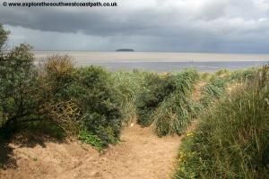
This walk begins from the town of Brean. Brean is a village mostly along the road with large caravan and holiday parks on either side so is primarily a holiday base. From the road opposite Brean Leisure Park, take the sandy footpath signed west off the road, which leads down to the beach. The beach here is a huge with Brean Down to the right and Berrow and Highbridge to the south, whilst across the river Parrett you can see the coast of West Somerset including Hinkley Point power station and the Quantock hills beyond. Out to sea you can see the island of Steep Holm (and you may also be able to see Flat Holm). In the distance you can see the coast of Wales.
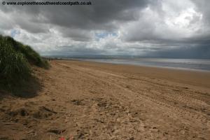
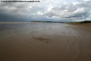
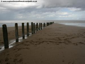
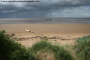
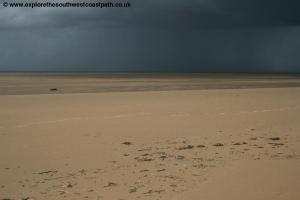
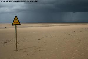
On reaching the sea, turn left and simply follow the beach. The beach here is massive at low tide, with the tide going out over a mile revealing a mixture of sand and mud flats, so care needs to be taken at low tide and for this reason the beach is not great for bathing unless the tide is high, as it is muddy. Keep the dunes on your left and the sea on your right and it is best to keep on the hard sand closest to the dunes, as going further out can you leave you cut off by muddy streams, mud banks and areas of sinking sand. Soon you leave the confines of Brean and continue with dunes on the left, passing through Berrow. The beach here often has debris washed up and the tide does reach the dunes when it is very high so you may be forced onto the road which goes the other side of the dunes.
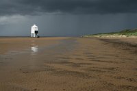
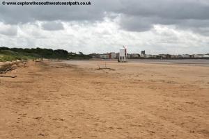
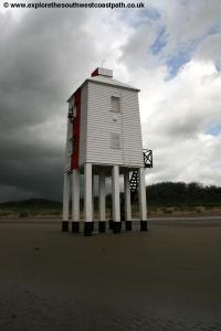
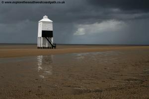
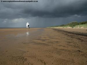
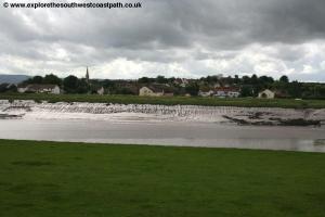
Continue on the beach for a couple of miles through Berrow and soon to Burnham-on-Sea. You pass the unusual wooden lighthouse built on stilts on the beach at the north end of Burnham-on-Sea.
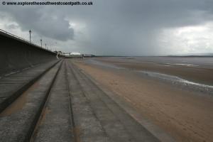
As you approach Burnham, you can either continue on the beach (if the tide is out) or the promenade along the back of the beach. The beach here is backed by a concrete sea wall, providing coastal defences for the town. Soon you pass what claims to be Britain's smallest pier, a small building built over the beach, the former pier no longer existing.
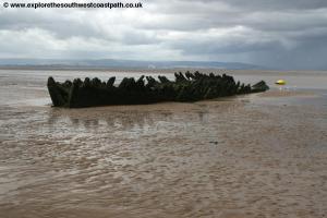
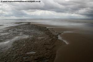
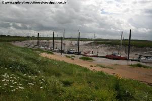
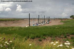
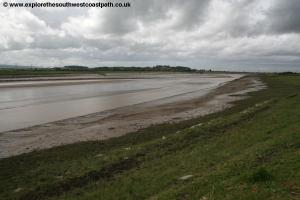
As you head south, the beach largely becomes mud rather than sand as we near the mouth of the Parrett estuary. You can see a few little islands that have formed on the mud banks just out to sea, Stert Island being the nearest. Pass the lifeboat station and a little jetty and continue to the south end of the beach where we come to the first river estuary, the river Brue. Here the road ends, but you can take the path straight ahead which is a combined footpath and cycle path along the north edge of the river. This is a pleasant walk alongside the river, with it's muddy banks visible at low tide. The river twists and turns, but the path follows a more direct route, cutting off some of the turns.
You pass Apex Leisure Park on the left, an area of parkland and lakes which borders a caravan park. When the tarmac cycle path comes to a junction turn left and follow this alongside the sewage works on the left. Keep ahead on the track past an industrial site on the left and houses on the right. Follow this to it's end, where you reach Newtown Road and continue straight ahead along this (a slight right turn at the end of the track). Continue ahead with the road as it becomes Tyler Way. Soon you approach a large roundabout near the centre of Highbridge. Turn right here alongside the A38. If you wish to visit Highbridge, turn left along Church Street or for the station, go ahead along Market Street.
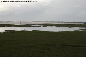
To continue the walk keep with the busy A38 until you cross the river. Immediately here you turn right on the signed footpath which goes west, parallel with the river with trees on your right. This soon opens out to a large field and you continue straight ahead with the river on the right. Another footpath joins on a path from the right and you continue ahead on the sea wall as the trees on your right end. This area is used for grazing and the parts of the land to the right of the sea wall do flood on occasion.
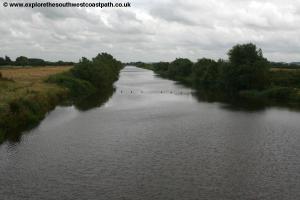
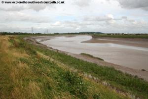
Keep with the main sea wall path as it turns to the left and joins the coast at the mouth of the River Parrett, which we now follow for the rest of the walk. Here you have a choice. The official right of way runs along the sea wall, but there is a concrete track right along the edge of the river which you could also follow although when the tide is high it does flood over this and it is also made in part by lose concrete bricks so the sea wall route is recommended rather than this track. As you pass along the river you'll see various navigational lights, presumably to help direct boats into the river at night. The concrete path soon crosses the sea wall and you continue south on the sea wall, next to a surfaced track. Soon you reach the Huntspill River which is crossed via a sluice gate.
As you approach it appears this is fenced off, but there is a narrow footpath just to the right of the concrete building on top of the sluice gate (which is a public right of way). Here continue south on the sea wall, which is now a little inland from the river, as part of the land to the right now floods by the river. Soon you return to the river bank and keep going south passing near to Yearsley Farm on the left. Keep to the surfaced track along the sea wall soon passing under the pylons that lead out from Hinkley Point Nuclear Power station which you can see on the other side of the river on the right.
Keep with the river as it turns to the south and passes the village of Combwich on the opposite bank.
Follow the path along the sea wall with the river on your right as you go around the bend in the river. There are a few gates you need to go through on the path here (most of which have stiles next to them, if the gate is locked). Soon the track along the sea wall heads inland but you keep to the sea wall now on a grassy path. You pass near a rusty old barn to the left (part of Gaunt's Farm, I believe) and continue with the power lines close by on the left until you come to Brickyard Farm, a farm on the river.
Just before the farm turn left on the footpath, to the right of a drainage channel and follow it as it goes to the right of the driveway to a house and then joins the road, where you turn left. Ignore roads to the left and right as you head north until you reach the end of the road at a T-junction with Gaunts Road, where you turn right. Continue along Gaunts Road, as it turns left and comes to Old Main Road, which as the name suggest is the former A38 (which now by-passes the village). The walk ends at the post office just at the end of this road.
![]()
Unfortunately there is no longer a direct bus between Brean and Pawlett. Instead you will need to take The Buses of Somerset route 21 from Pawlett to Burnham-on-Sea, which runs twice an hour Monday to Saturday and hourly on Sunday. From Burnham-on-Sea take First Bristol, Bath and West route 20 to Brean which runs twice an hour Monday to Saturday and hourly on Sundays during the summer. In winter the bus runshourly Monday to Saturday but has no service on Sunday.
![]()
Here are some photos taken on this walk. Click each photo for a larger version and description.
 |
 |
 |
 |
 |
 |
 |
 |
 |
 |
 |
 |
 |
 |
 |
 |
 |
 |
 |
 |
 |
|
![]()
Ordnance Survey Explorer maps 153 (Weston-super-Mare & Bleadon Hill) and 140 (Quantock Hills & Bridgwater) cover this walk. They are available from local book shops, tourist information centres and online retailers. In addition the links below show the map of this area.
![]()