|
|
 |
|
|
| < Stogursey to Watchet | Minehead to Porlock > |
| Distance : 8 miles | Grading : ++ | OS Sheet : OL9 |
![]()
This walk takes in the western part of the West Somerset Coast Path along a spectacular stretch of coastline which heads through the hills on the edge of Exmoor and passes the pretty village of Dunster. The first part of the walk is hilly but the latter is flat.
![]()
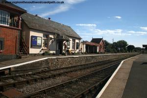
The walk begins from Watchet. To get to Watchet leave the M5 at junction 25 and follow the A38 into Taunton. Follow the signs in Taunton for the A358 for Williton. Note that Taunton can get quite congested at times. You then continue along the A358 through numerous villages (which makes for a slow drive) to Williton. Here go straight ahead onto the B3191 towards Watchet. There is then a rather awkward right turn (as it has poor visbility) onto the B3190 which you follow to the centre of Watchet. There are a couple of pay and display car parks in the centre of the village including one by the railway station. The A39, the main road across north Devon and West Somerset also goes through Williton providing a link to Minhead and North Devon.
If you are coming by public transport there are several bus services to Watchet. The Buses of Somerset route 28 runs twice an hour Monday – Saturday from Taunton to Minehad and stops in Watchet, with the journey from Taunton taking around an hour. The bus also serves Taunton railway station for those arriving by trains which has frequent services between Bristol and Exeter and longer distance services to Plymouth, Cornwall, London, the Midlands and North. This bus also runs on Sundays, on an hourly basis. In addition the The West Somerset Railway operates trains to Watchet for much of the year on a route from Bishops Lydeard to Minhead via Watchet using a mixture of steam engines and diesel services. Note that this is a heritage railway so ticket prices are much higher than National Rail services, but it is a pleasant journey.
![]()
There is a fairly limited choice of accommodation in Watchet. The Mariner, Watchet is a guest house in Watchet and offers 5 rooms. The Georgian House, Watchet is a distinctive guest house in the centre of Watchet. Visit Watchet Accommodation is a list of accommodation in Watchet. There is a much wider choice of accommodation available in Minehead at the end of the walk.
![]()
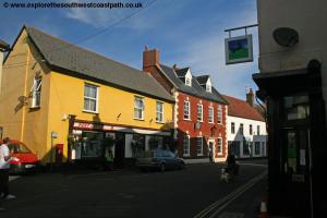
From the centre of Watchet follow the signs to the harbour. This is a working harbour at the eastern end, with much of the rest given over to a large marina. Follow the pleasant promenade along the back of the harbour. As the promenade behind the harbour ends you continue along the road straight ahead, Market Street, passing the museum on the right. This is an attractive street with a few shops.
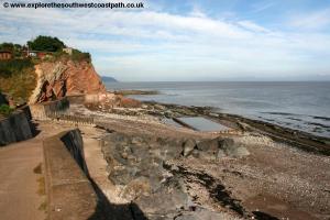
Continue past the entrance to a small car park on the right at the mouth of the harbour and continue as the road now becomes residential in nature and becomes West Street. After the first half dozen or so houses on the right there is access under an arch on the right to the small beach. This is a rocky beach, with a small tidal bathing pool at low tide, but unfortunately there is no access along the coast north here so to continue the walk you must continue on the road. The road continues to climb and passes a residents car park on the right. Continue past a modern development on the left and soon the houses end but unfortunately the road narrows and there is no pavement so care is needed here. Nearing the top of the road, the road widens as the speed limit increases. Continue on the right hand side of the road here, with fine views through the bushes to the right. Just after the crash barrier on the right ends you see a footpath sign to the right which you take, as the coast path now leaves the road.
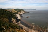
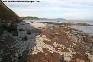
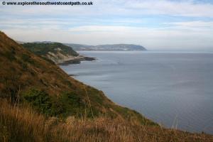
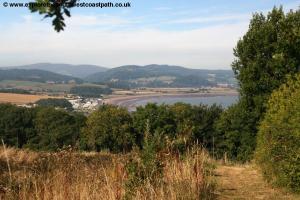
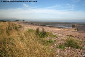
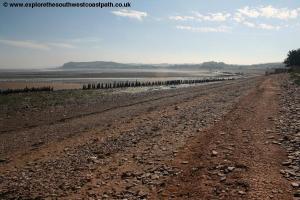
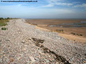
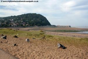
Note that this is a permissive path not yet shown on the Ordnance Survey Maps. You now follow this spectacular path along the cliff tops through the next few fields. Below to the right is the pretty beach of Warren Bay. Like most beaches on this part of the coast it is rocky and has a huge tidal range, revealing a mixture of sand and mud as the tide goes out. You continue on the path along the edge of a caravan and camp site on the left (there are likely to be people camping along this edge of the field in the summer) and then go through a gate to enter a wooded section of the path, which offers occasional views over the sea to the right.
This is a pleasant part of the walk and the path fairly easy to follow, just keep to the most coastal route, which is well signed. Soon the path emerges from woodland and you continue along the path along the coastal edge of the next three fields, with views down to the sea to the right. After these three fields, the path enters woodland again. Here unfortunately the right of way marked on the map has been closed due to erosion and there is a rather unsatisfactory diversion. This is to turn left away from the coast towards the road and then walk parallel to the road. This route is marked on recent Ordnance Survey Maps but is poorly signed and there are many more paths on the ground than on the map. The best advice I can offer is that whenever there is a choice of paths, keep to the more coastal route as long it is a fairly wide path. This seems to bring you out to the right place where you then follow a path parallel to the road with a caravan site on the other side of the road.
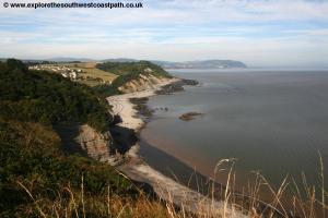
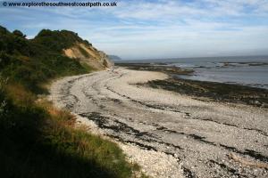
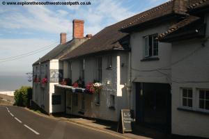
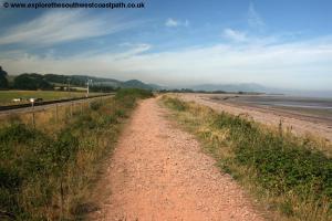
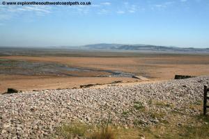
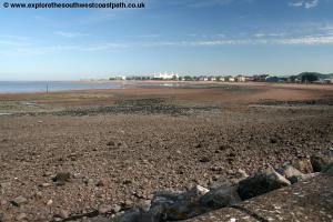
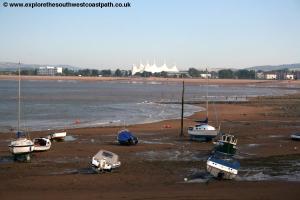
Follow this path next to the road until it emerges on the road beside the Blue Anchor pub on your right, on the edge of the small village of the same name (I believe it was named after the pub). Continue on the road and follow the wide pavement beside the road. Blue Anchor Bay is a lovely beach wit lots of sand (though again there can be mud at low tide), and with fine views ahead to Dunster and Minehead. Continue on this path as you soon pass a large caravan park on the left. As the road starts to turn left inland to Blue Anchor station (which you can see), take the path straight ahead. As the signs state, you should stick to the shingle and pebbles at the back of the beach rather than the path in front of the bungalows which is signed as private.
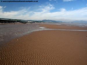
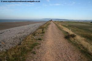
The path ahead is now easy , along the top of the shingle bank with the sea to your right and railway line parallel on your left. You follow this path for just over a mile along the shingle bank until you come to a concrete drainage channel. Here you have to head a few metres inland to cross this via the footbridge and then return back to the coastal path. You now pass through a gravel car park, part of Dunster beach with the village of Dunster clearly visible to the right, dominated by it’s castle and to a lesser degree the church and Conygar Tower. Dunster is a lovely village and well worth exploring, with many attractive walks in the area too. The village is a around 1.5 miles inland here, which you can reach along the road and then signed footpath.
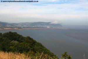
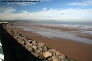
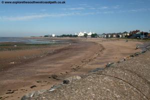
Continuing on the coast, as the car park ends you pass a site of numerous chalets, mostly with asbestos roofs and follow the path in front of these. When these ends, you continue on the path ahead along the coastal side of the golf course. This is mostly easy going and after about half a mile starts to turn more to the west with the coast to come to the edge of MInehead. Here the path becomes very sandy and briefly enclosed between hedges until you descend down to the road at the eastern end of Minehad. This initially follows the car park on the left, with the large Butlins Holiday camp to the left. Ahead you can see the hills of Exmoor looming over the town and the harbour at the far end of the bay. Continue past the Butlins and some modern flats where you then pass a couple of shops and an arcade on the left. The railway station is just behind these.
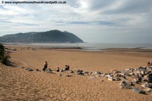
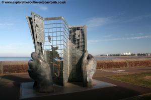
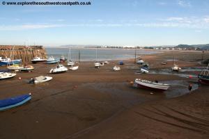
Continue ahead with the promenade as it now becomes quieter and mostly residential, with the good sandy beach on the right. Soon part way along this part of the promenade you come to the large artwork of a hand holding a map. This marks the end of the West Somerset Coast Path and the beginning of the South West Coast Path, which follows the coast from here right around the western tip of Cornwall to finish at the mouth of Poole Harbour in Dorset, more than 600 miles away! Although this is the end of the path it is recommended to continue to the pretty little harbour where you also get a view all the way back around the bay.
![]()
To return to Watchet The Buses of Somerset bus service 28 runs every 30 minutes Monday – Saturday back to Watchet and takes a little over 30 minutes. This bus runs hourly on Sundays. As an alternative, a lovely way to get back is to take the The West Somerset Railway . Whilst this is not cheap and takes a little longer than the bus, it does offer you wonderful views back along the coast path you have just walked, as the line runs close to the coast most of the way other than a diversion inland to Washford.
![]()
Here are some photos taken on this walk. Click each photo for a larger version and description.
 |
 |
 |
 |
 |
 |
 |
 |
 |
 |
 |
 |
 |
 |
 |
 |
 |
 |
 |
 |
 |
 |
 |
 |
 |
|
![]()
Ordnance Survey Explorer Map OL9 (Exmoor) covers this part of the coast between Watchet and Minehead and is easily available locally. It is also well stocket in book shops nationwide and via online shops.
![]()