|
|
|
|
|
|
| Distance : 5 miles | Grading : ++ | OS Sheet : 203 |
![]()
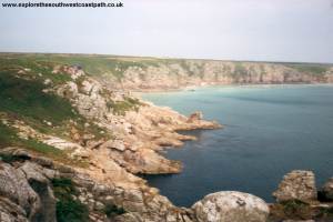
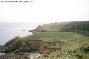
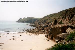
This walk starts in the village of Porthcurno in the South West of Cornwall. There is a wonderful beach at Porthcurno (owned by the National Trust) and the world famous Minack Theatre, an open air theatre perched on the cliff top overlooking the beach. Porthcurno was also the sight of the first international telegraph cable. The walk passes through some spectacular scenery, with many rocky bays before arriving at Lands End, the most South Westerly point of main land Britain.
![]()
Porthcurno is on an unclassified road, just off the B3315 from Newlyn. The road is a left turn as you head towards Lands End and is called The Valley. There is a car park at Porthcurno with room for around 100 cars. It does get busy in the summer though, so you might have a problem parking if you arrive too late.
If you're traveling by public transport, First Western National run a bus service from Penzance and Lands End to Porthcurno, running approximately hourly. The bus station in Penzance is next to the rail station from where there are long distance and local rail services. For more information, see the links below.
As both Porthcurno and Lands End are fairly remote, accommodation is limited. The resorts of Penzance, Newlyn and St Ives nearby do have a much larger choice of accommodation. There are tourist information centres at St Ives and Penzance with information on local accommodation. The links below provide more information.
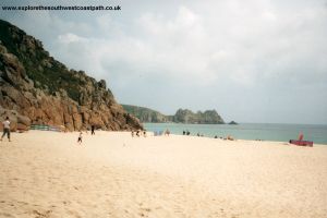
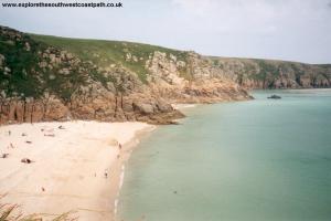
Porthcurno has an excellent beach. The sand is made of mostly broken shells which give the sea a wonderful turquoise colour, even on a cloudy day. The beach is now owned by the National Trust, having been donated from Cable and Wireless in 1994. At low tide other parts of the bay become accessible where sand forms. Porthcurno was also the site of the first international telegraph cable into Britain. Porthcurno is still an important communications centre with new fibre optic links from the US arriving here. The Museum of Submarine Telegraphy is an interesting museum about Porthcurnos past as a communications centre, it is open all year, with more limited opening in the winter (for more information, check the links section below).
Refreshment is very limited in Porthcurno, there is a beach cafe which is usually open from Easter to the end of September, but it is a little distance up the valley. There is also a pub in the village. You may hear mention of the Logan Rock, which is the large rock to the east end of the beach. There is a story (I don't know if it's true or not), that the rock could be rocked by fingertip pressure alone but that in 1824 a naval lieutenant and his shipmates managed to push the rock onto the beach. He was then ordered by the local people to replace the rock at his own expense.
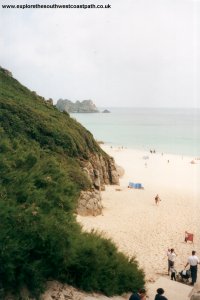
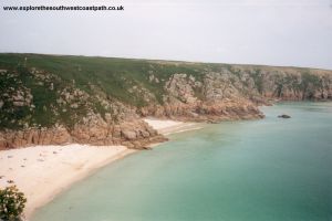
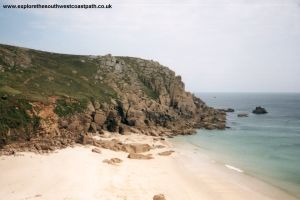
The coast path is easy to find, leaving from the beach and you very soon pass the spectacular Minack Theatre. This is an open air theatre on the cliff top overlooking the magnificent beach from where you can see a play as the sun goes down over the bay. The theatre is open from late April until mid to late September with a variety of productions. There is also a cafe and visitor centre and coffee shop which is open all year round. Once past the Minack Theatre it is a fairly easy walk round to St Levan where there is another excellent sandy beach, known as Porthchapel. This beach is a lot quieter, mainly due to the poor access.
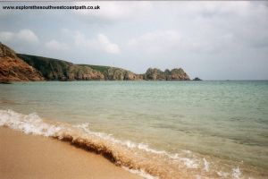
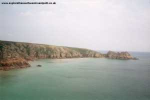
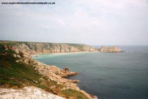
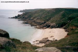
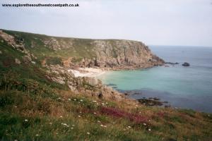
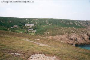
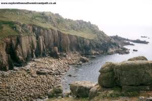
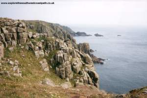
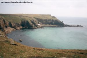
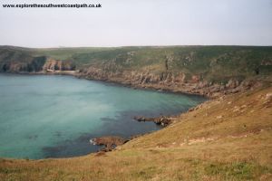
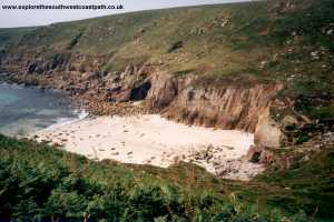
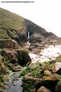
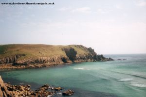
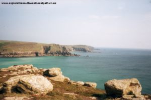
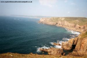
From Porthchapel, it is a short climb up from the beach, then an easy walk, past a shingle beach to Porthgwarra. There are a few houses here and a small shop (open in the summer only). There is a small sandy beach, accessed via a tunnel. After Porthgwarra it is again a fairly easy walk around round Gwennap Head and round into Porth Loe. The path remains fairly gentle as you round Folly Cove and Pendower Coves. The sea here is very shallow, making the sea in these bays appear a lovely blue, especially on a sunny day. There is a more step descent and then a climb out of Nanjizal (which has a good sandy beach) but after that the path is relatively easy going into Lands End.
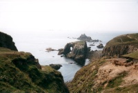
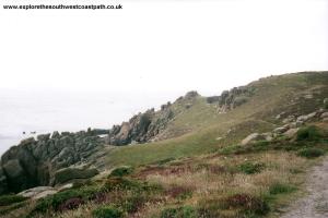
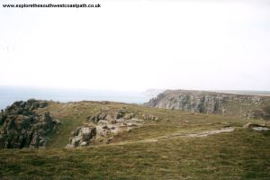
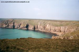
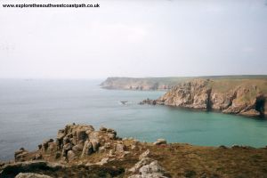
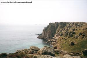
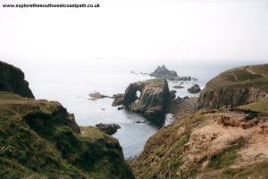
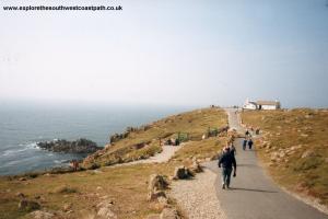
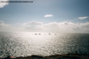
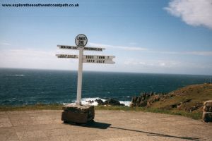
As you approach Lands End you will see the spectacular rocks, including Enys Dodnan, the rock with the arch through it. The more pointed rock behind is known as Armed Knight. Lands End is just a few minutes walk away now. There is the aptly named first and last refreshment house here. There is also the large Lands End Hotel and a sign post, where you can get a photo of yourself with the name of your home town and distance from Lands End. There is a similar post at John O Groats. Longships Lighthouse can easily be seen off the coast and this really is a spectacular point of the coast path. There is also a theme park a little inland, which makes this quite a busy spot. However, at least during the summer it does mean there are more facilities here than you might otherwise expect.
If you're returning by bus there is a stop at Lands End, on the edge of the car park.
Despite being such a remote location, there is a bus running throughout the year. First Western National service 1 runs approximately hourly to Lands End, and goes to Porthcurno and Penzance, with some buses running via Sennen Cove on the way. Sunset Coaches also operate an infrequent service between Lands End and Penzance, service 345 with some stopping at Porthcurno. For more details on all of these services, see the links below.
Here are some photos of the walk. Click a picture for a larger version and description.
 |
 |
 |
|
 |
 |
 |
 |
 |
 |
 |
 |
 |
 |
 |
 |
 |
 |
 |
 |
 |
 |
 |
 |
 |
 |
 |
 |
 |
 |
 |
 |
 |
The following photos and panoramas are from Paul Stephens' site.
Ordnance Survey Landranger map 203 covers this area of the coast path and is available from most book shops nationwide. It is also stocked at the tourist information centre in Penzance.
 Streetmap is a web site which provides maps of the UK, including around around Porthcurno and Lands End. The links below will be of most use to the coast path from Porthcurno to Lands End. These maps join to provide the complete coast path between the two points.