|
|
|
|
|
|
| Distance : 4 miles | Grading : ++ | OS Sheet : 200 & 203 |
![]()
The popular resort of Perranporth is the start point of this walk. Perranporth has an excellent sandy beach, backed by sand dunes and cliffs further North and there are good facilities here. This walk takes an interesting area, littered with the remains of many years of mining, there are many old mine shafts and buildings visible. The walk passes through some of these old mining areas and also pass a small airfield. There is another good beach at Trevaunance Cove from where the village of St Agnes is a short walk inland.
![]()
Perranporth is on the B3285, which is just off A3075 from Newquay and the A392 which joins the A30. There is a car park behind the beach.
If you are traveling by public transport, Truronian service T1 runs approximately every two hours from Lizard, Mullion, Helston, Truro and St Agnes to Perranporth. There are other regular buses from Truro and Truro station to Perranporth. For more infromation, see the link below.
There is a good range of accommodation in Perranporth and St Agnes, including self catering. The links below give information on accommodation in the area.
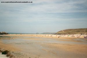
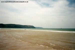
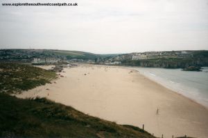
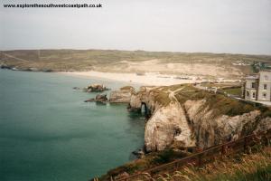
The biggest attraction of Perranporth is it's excellent beach, which stretches for some three miles. As the beach is so large it is not usually as crowded as the beaches in nearby Newquay. Much of the beach is also backed by extensive Sand Dunes. There are a good range of shops in Perranporth. The coast path starts near the car park, climbing up Cliff Road and up Tregundy Lane. There is a Youth Hostel along the coast here but the coast path is well signed and goes up onto Shag Rock.
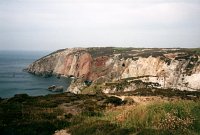
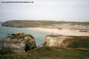
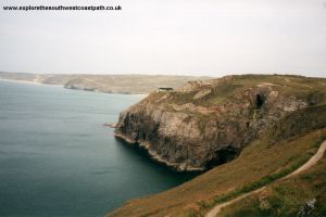
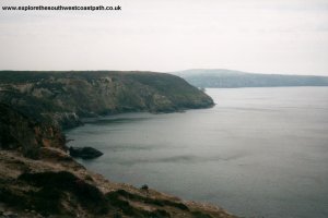
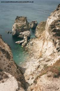
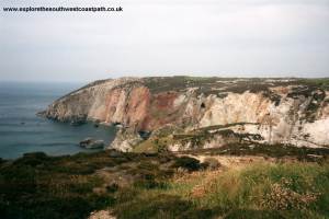
The path beyond Shag Rock goes through the remains of many old mines. The old mine shafts are typically covered with a wire mesh, but take care along here. There is also the remains of some old mine buildings. The path is fairly easy going from here to Cligga Point. The headland here shows a lot of evidence of mining, and the minerals in the rock can easily be seen by the varied colours of the rock.
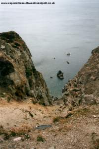
The coast path then passes through the remains of more old mines before getting to Hanover Cove. There are many mineral deposits in the rocks around here, and the bay is named after a boat which sank here in 1763 which was carrying Gold Bullion. Part of the wrecked ship can still be seen at low tide. Inland from here is Perranporth Airfield, so you might notice the odd plane passing overhead.
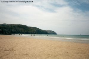
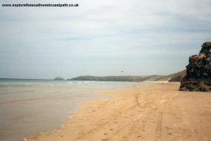
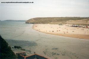
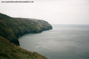
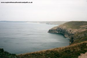
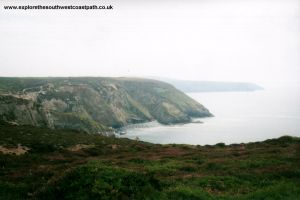
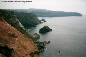
The path around the edge of the airfield is easy going with some gullies cutting into the cliffs. The island is known as Green Island. The path then descends sharply at Cross Coombe, where there are some more old mine workings. Pass the old engine house and mine workings at Blue Hills and then round the cliff to Trevaunance Cove. The beach here is excellent but does get very busy in the summer months. There are rocks under the water in some places though. To the left of the beach, where all the rocks are is the remains of a small harbour. The town is a little back from the cove. If you are returning by bus, the bus departs from St Agnes Hotel, in land near the post office and church.
Truronian service T1 departs from St Agnes Hotel roughly every two hours to Perranporth. I think it runs more frequently in the summer. If the bus does not run at a suitable time, there are taxis available.
Here are some photos of the walk, in roughly the correct order. Unfortunately, I ran out of film as I was approaching St Agnes, so there are no photos of this part of the path. Click each picture for a larger version and a description.
|
|
|
|
|
|
|
|
|
|
|
|
|
|
|
|
|
Ordnance Survey Landranger map 200 covers Perranporth and map 203 covers the area around St Agnes. Both maps are available from most book shops nationwide and are also stocked at the Tourist Information centre in Newquay.
 Streetmap is a web site which provides maps of the UK. The links below will be of most use to the coast path from Perranporth to St Agnes. These maps join to provide the complete coast path between Perranporth and St Agnes.