|
|
|
|
|
|
| Distance : 3 miles | Grading : + | OS Sheet : 203 |
![]()
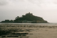
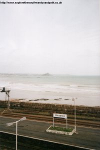
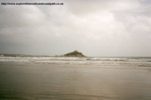
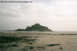
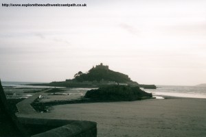
This walk starts in the town of Penzance, in the far south west corner of Cornwall. It passes along the beach, one of the most beautiful in the world, to St Michael's Mount. This unique island, with castle, is linked to the village of Marazion by a causeway at low tide and ferry at high tide and is open to the public.
This walk does involve some road walking out of Penzance, although there is a footpath, the road is busy. Once past that, there is a path at the back of the beach, or you can walk on the beach. The walk is fairly short and mostly flat, other than a brief climb as you leave Penzance.
![]()
Penzance is located at the end of the main A30 and so is very easy to access. There are several car parks in the town, the best for the walk would be the one just to the west of the station.
If you're traveling by public transport, there is a main line station at Penzance, which has frequent trains from Truro, Plymouth and beyond. There is also a local line from St Ives to Penzance. For more details on rail services call 08457 48 49 50 or see the link below. Local bus services operate to Penzance from Marazion, Praa Sands, Newlyn, Mousehole, Lands End, Porthcurno, St Just and St Ives. For more information on these bus services, call 01209 719988 or see the links below.
There is a good range of accommodation in Penzance, but there is less choice in Marazion. It may also be worth considering St Ives, which also has a good range of accommodation. There is a tourist information centre in Penzance, which carries a full list of local accommodation. For more information, see the links below.
Penzance is in the far west corner of Britain. It's a pleasant town, with a reasonable range of shops, restaurants, pubs and cafes. There is also a working harbour, where a ferry runs to the Isles of Scilly. This walk starts near the station on the sea front. There is now a new coastal footpath along the sea wall next to the railway line, which continues along to the footbridge to join the old path.
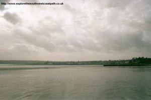
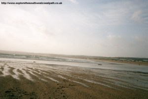
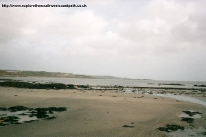
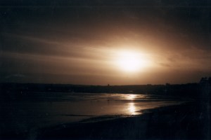
This path continues all the way into Marazion, but you may also choose to walk along the beach if the tide is out. The beach here is a mixture of sand and shingle, and is very clean. Mounts Bay has been named one of The Most Beautiful Bays in the World and it's not difficult to see why, with the stunning views towards St Michael's Mount. The path passes the small village of Long Rock, where there is a pub occupying the old station building.
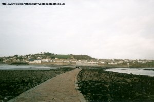
After leaving Long Rock, it is a little over a mile to Marazion. St Michael's Mount is open to the public and is managed by the National Trust. The island is still inhabited and the castle, which dates from the 12th Century, is also open. There is a causeway over to the Mount, which is covered at high tide. There is also a ferry service in the summer months (and some times in the winter), when the tide is in. Buses run frequently from Marazion back to Penzance.
Bus services run frequently from Marazion back to Penzance, roughly every 15 minutes for most of the day. For more information on these services, see the links below or call 01209 719988. Timetables are available from the bus station in Penzance or the Tourist Information Centre.
Here are some photos of the walk. Click a picture for a larger version and description.
 |
 |
|
|
|
|
|
|
|
Ordnance Survey Landranger map 203 covers this area of the coast path and is available from most book shops nationwide. It is also stocked at the tourist information centre in Penzance.
 Streetmap is a web site which provides maps of the UK, including around around Penzance and Marazion. The links below will be of most use to the coast path from Penzance to Marazion. These maps join to provide the complete coast path between the two points.