 |
|
|
| Distance : 14 miles | Grading : ++++ | OS Sheet : OL9 |
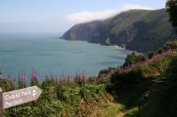
This walk covers much of the spectacular Exmoor coastline. It begins from the town of Lynmouth in a deep valley of the river Lyn and immediately climbs east along the spectacular cliffs, past the lighthouse at Foreland Point and continuing around Contisbury Cove. The walk soon enters woodland that covers the top of the cliffs and continues east through the quite woodlands passing the tiny Culbone church and coming into Porlock Weir to the western edge of Porlock Bay. The walk continues to finish in the village of Porlock a short distance inland.
The walk begins from Lynmouth. If you are travelling by car, Lynmouth is along the A39 road that runs along the north edge of Exmoor. It is worth noting that there are very steep hills into Lynmouth, whether you come from the west or the east and great care needs to be taken particularly in bad weather. The road, despite being an A-class road has many tight bends, steep hills and some small single track sections. There are several car parks in Lynmouth (pay and display) or you may prefer to park in Lynton and take the cliff railway or walk down to Lynmouth. Due to the limited public transport between Porlock and Lynmouth (see below) you may prefer instead to park in Porlock and travel by bus into Lynmouth so you can walk back to your car in your own time.
If you are travelling by public transport, bus services 309 and 310 provide a broadly hourly service to Lynton and Lynmouth from Barnstaple. There is a railway station at Barnstaple with train services to Exeter from where there are connections into long-distance trains. In addition there are two 300 bus services. One runs west into Combe Martin and Ilfracombe and the other runs east to Porlock and Minehead.
There is a good choice of hotels and bed and breakfast accommodation in Lynton and Lynmouth. For details see the links below or call the tourist information centre on 0845 6603232. There is also a good choice of camping and self catering accommodation available close by.
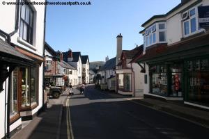
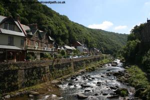
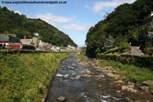
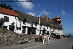
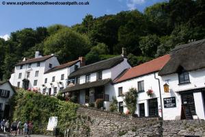
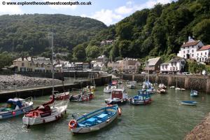
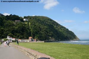
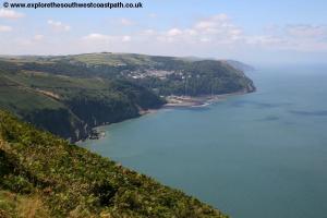
Lynmouth (and it's neighbor Lynton at the top of the cliffs) is a really beautiful town known as Devon's little Switzerland due to the very hilly nature of the surrounding countryside. This makes for a stunning walk but also a fairly tough and long walk. The town nestles in the Lyn valley with the pretty river flowing through the middle of the town. However it was not always so peaceful, with the river bursting it's banks and seriously damaging the village in 1952, when many of the buildings were destroyed or seriously damaged, with many losing their lives in the floods.
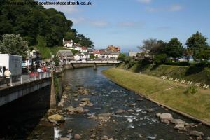
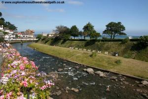
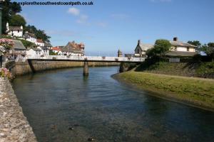
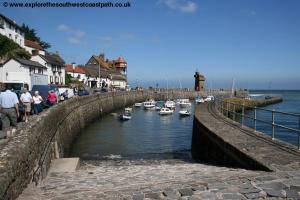
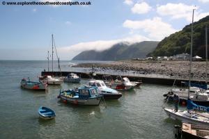
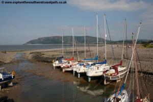
The walk begins from the foot of the Lynton and Lynmouth cliff railway. This unique railway line runs up the steep cliffs between the two towns and is powered by water. The two cars (one at the top and one at the bottom) are powered by filling tanks under the car at Lynton with water causing it to becoming heavier and the weight of the water pulls the top car down and the bottom car up, since the two are connected. From the cliff railway station turn right along the road with the spectacular bay to your left. You round the corner past the souvenir shops and the pier beside which many boats are moored. Cross the white footbridge over the river when you come to it and enjoy the fine views along this now peaceful stream. Once across turn left and follow the wide promenade around the back of the bay. Pass the last of the buildings at the end of the promenade and the path then climbs fairly steeply up the edge of the cliffs towards the A39 road. You soon have stunning views around this impressive bay with the town at the bottom of the valley.
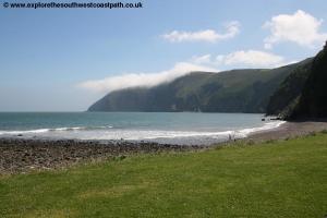
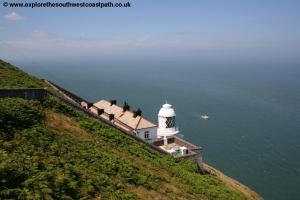
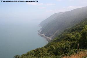
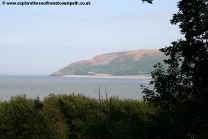
The path keeps just below the A39 road as it makes it's way up the very steep hill beside the path. Keep east just below the road along this wonderful stretch of the path. There are a few seats from where you can enjoy the view. Once you reach the top, the path undulates along the top of the cliff tops. After a little over a mile the path turns to the left and leaves the A39 behind. The path turns north east along the cliff top passing close to the village of Contisbury and then on to the top of Butter Hill offering fine views of the coast. At the junction of paths just beyond Butter Hill take the path to the left (signed as the coast path) rather than the path to the right. You have more fine views from the top of the next cliff top from where you have a choice of routes. The official route of the coast path turns right here, away from the coast for a short distance. There is an alternative path around the headland (known as The Foreland). This is marked as a dangerous path as it is no longer being maintained. The path is very close to the cliff edge and does have some lose pebbles along parts of it, so great care is required along the path although if it is dry and not windy you should not have much trouble. I chose to walk this route, but the choice is yours! Following the route to the light house take the path very carefully as there is lose shingle and pebbles in places you gradually descend down to the light house at Foreland Point from where you have excellent views over to the South Wales coast line. On reaching the light house keep to the path around until it descends onto the road to the light house. This is a private road so there is very little traffic using the road. You now follow this road around the next little bay and then on reaching a steep valley (Coddow Combe) the road climbs up the west side of this valley to re-join the official route of the coast path where you turn left.
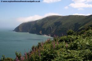
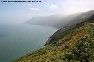
The path now heads east and soon returns to the cliff tops. This area is a lovely part of the path with many little streams flowing over the rocky ground and heather and bracken lining the cliffs. You pass over Kipscombe enclosure a small woodland and then through Chubhill Wood a small area of woodland. You emerge from the woodland and continue east to a point where you have good views of the surrounding coast. Keep going east and you have to round the steep valley of Wingage Combe above the perhaps appropriately named desolation point! Returning to the coast you go above the oddly named cliffs of Handball to come to the top of the hill at Glehnthorne Plantation. Enjoy the view back west here as you now enter the woodland.
Follow the path as it turns south to come to Sisters Fountain and another valley known as The Combe. Turn to head east here. A path south heads to County Gate, the border between Devon and Somerset where there is a visitor centre and toilets in the car park, although it is quite a few minutes walk from the coast path. Keep to the coast path east through more woodland to pass by another valley, Yenworthy Combe. Just east of here you have a choice of routes, you can either take the route closest to the coast or a route along farm tracks and footpaths a bit further south. The route described here is the former through the woodland.
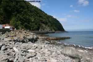
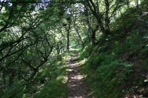
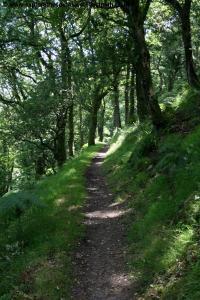
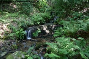
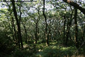
Care needs to be taken here as whilst there is a path continually through out the woodland, and it is well maintained, due to the number of land slips and fallen trees the route changes quite frequently. However the sign-age is always updated with any new routing and is excellent along this section. The woodland has numerous little water falls all along it's length as the streams formed on the top of Exmoor tumble over the cliffs to the sea. Due to the tree coverage, views of the coast are fairly limited but this is simply the nature of the terrain, since all the cliff tops are heavily wooded here. Note that there are usually stepping stones over these streams, but in some cases you may have to step over them or stand on rocks in the flowing water so care and appropriate footwear are needed.
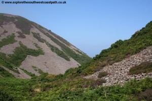
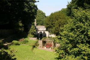
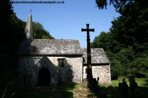
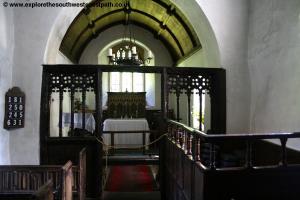
The first valley you cross is Wheatham Combe and then on to Broomstreet Combe and Holmers Combe. The area of woodland is now known as Culbone Wood and just after Silcombe Combe you can enjoy a view through the trees to the coast line around. Return to the path and head east to come to the tiny hamlet of Culbone. Here you will find the tiny Culbone Church, reputed to be the smallest complete parish church in England. It is usually open and donations are invited. This is a very remote spot for a church with very limited road access and it's a wonderfully peaceful place, with only the sound of the nearby stream.
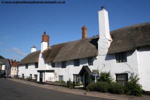
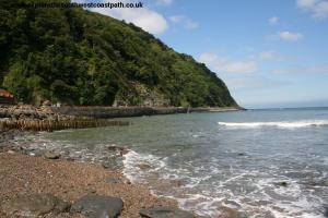
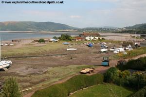
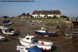
Continue from the church eastwards along the wide track for around a mile to reach the hamlet of Worthy, passing under the gate. A toll road goes south here through the woodland and you pass under the toll gate and briefly along the road. Fork left when signed away from the road to descend into the village of Porlock Weir. Here you enjoy fine views around the bay. Porlock Weir was once a working harbour but is now largely limited to a small fleet of fishing boats and pleasure craft. You'll find a pub in the village if you are after refreshment.
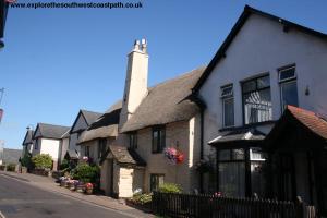
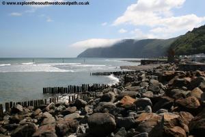
The walk continues from Porlock Weir to Porlock, although there is an occasional bus service on to Porlock if you prefer. To continue the walk you initially follow the road out of Porlock Weir and then as the road turns away from the beach you turn left along the often awkward track at the back of the pebbles on the beach. The path ahead is now cut off, as the shingle bank has been breached, flooding the land behind the beach and so when signed you should take the path to the right and follow it along the edge of some fields. The trees that once grew here have now been killed by the salt water and only there barks and the larger branches remain. A path goes off to the right soon to join the B3225 the road to Porlock Weir and West Porlock and this provides a shorter route to Porlock but you have to be careful of the traffic. Instead to keep on the coast path it soon turns left, heading almost north back along the edge of fields and past a small area of woodland at Butchers Plantation. Just beyond here take the official coast path turns right and then back left, but instead of taking the turn back left continue straight on along the path (Sparkhayes Lane). This passes a farm and becomes tarmac and comes to residential roads to the left. Keep following this narrow road past the camp site and on to the main A39 road through Porlock where the walk ends.
To return to Lynmouth bus service 300 runs several times daily during the summer. Note that there is also an occasional bus from Porlock Weir to Porlock. For details see the links below.
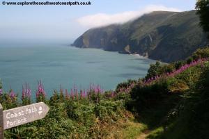
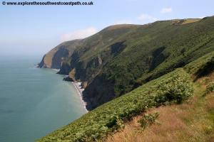
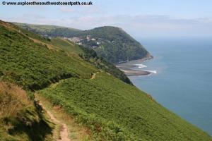
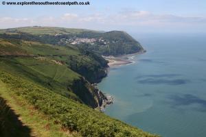
Here are some photos of the walk. Click each picture for a larger version and description.
 |
 |
 |
 |
 |
 |
 |
 |
 |
 |
 |
 |
 |
 |
 |
 |
 |
 |
 |
 |
 |
 |
 |
 |
 |
 |
 |
 |
 |
 |
 |
 |
 |
 |
 |
 |
 |
 |
 |
Ordnance Survey Explorer map OL9 (Exmoor) covers this area of the coast path and is available from most book shops nationwide and many local shops as well as the Lynton tourist information centre.
Streetmap is a web site which provides maps of the UK, including around Lynton, Lynmouth and Porlock. The links below will be of most use to the coast path from Lynmouth to Porlock. These maps join to provide the complete coast path between the two points.