|
|
|
| Distance : 8 miles | Grading : +++ | OS Sheet : 180 |
This is a very pleasant and scenic walk. Beginning in the popular resort of Ilfracombe, the path climbs out of the town onto the spectacular National Trust owned Torrs Walk into the village of Lee. There views on this section of the path are excellent and it is well maintained. There is a short section of road walking into Lee Bay, where there is a beach, consisting of slate from the cliffs. After Lee the path passes the spectacular headlands of Bull Point and Morte Point before arriving at Woolacombe. Woolacombe has a wonderful sandy beach, popular with surfers, spreading for a couple of miles to the south.
Ilfracombe is easily accessed from Barnstaple, with the main A361 road running into the town. There are car parks near the harbour and pier areas, and also a small car park near the Landmark theatre closer to the coast path.
If you're using public transport buses run frequently to Ilfracombe from Barnstaple, Braunton and Combe Martin. For more information on these services, see the North Devon Public Transport page. Trains run from the main line at Exeter to Barnstaple, from where there are buses to Ilfracombe and Woolacombe.
Ilfracombe is the main resort in North Devon and so has a very large choice of accommodation, including Hotels to suit all budgets. The choice is a little more limited in Woolacombe, but there are also Hotels here and also a couple of caravan sites nearby. There are tourist information centres in Ilfracombe (within the Landmark theatre) and Woolacombe, which carry a list of accommodation in the area.
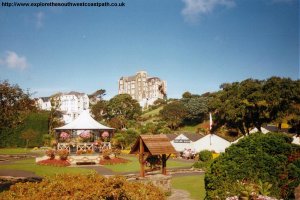
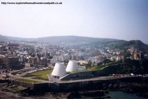
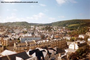
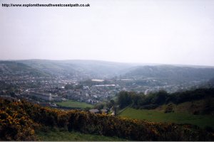
Ilfracombe is a popular town and the largest resort in North Devon. The signs for the coast path are not easy to spot in the town, but the best way is to head towards the bandstand and the Granville Hotel, which is on a hill at the back of the town. The coast path starts from the end of this road (Granville Road), which pases the Tunnels Beach. This beach was difficult to access here, and so a tunnel was built to provide access to the beach as the resort grew in Victorian times. The beach itself is a mixture of grey sand and shingle - there are much better beaches in the area. However, a separate gentleman's and ladies pools were constructed on the beach in Victorian times to provide safe bathing and still remain today, so the beach is well worth a visit if you have time. The only problem is that an admission fee is charged to reach the beach.
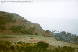
The coast path is signed from the end of Granville Road by the National Trust Torrs Walk sign. The National Trust own most of the land from here into Lee Bay, so it is well maintained. There is a climb out of Ilfracombe, but the path is zig-zagged making it less steep. There are good views back towards Ilfracombe as the path climbs out, and it quickly opens into pleasant countryside. The path is fairly gently sloping from here on towards Lee Bay, and the land here is open access, although there is an obvious path to follow. As you reach the end of the National Trust Torrs walk, there are a couple of houses, then the path joins the small road into Lee. Although there is no pavement, the road is very lightly used.
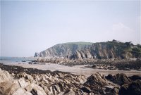
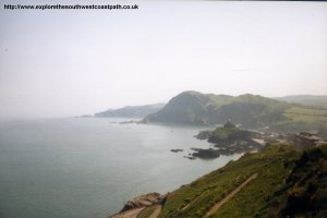
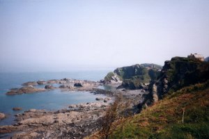
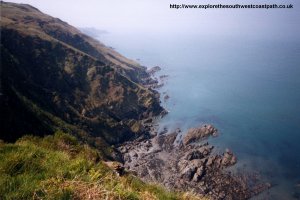
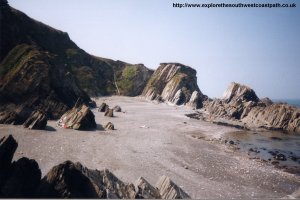
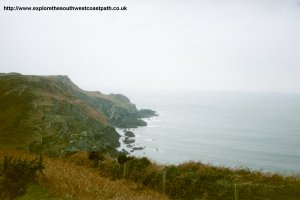
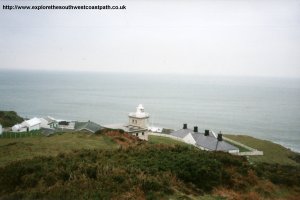
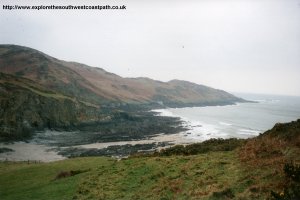
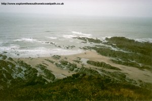
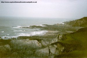
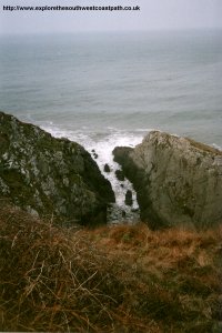
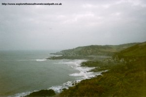
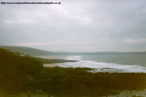
Lee is a pretty place, with a hotel and pub if you need refreshment. The beach is a mixture of sand and slate from the cliffs behind, making the beach a grey colour. The cliffs around here are impressive. There is a small stream flowing out into the sea at Lee Bay, but there is a bridge across it at the back of the beach. The path initially goes out of Lee on the road, but is then signed to the right. The climb out of Lee is quite steep. This part of the path is also part of the Tarka Trail which runs over much of North Devon. Soon after Lee Bay you will reach Bull Point, where this is a lighthouse. The path then heads South from here, and you soon arrive at the National Trust beach at Rockham Bay. This is a rocky beach, but there is quite a lot of sand at low tide. The lack of a large car park also means that it tends not to get as busy as the other beaches in the area.
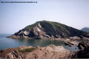
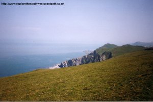
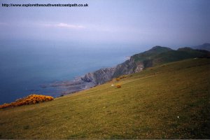
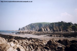
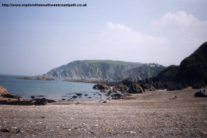
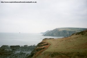
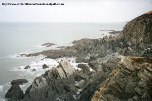
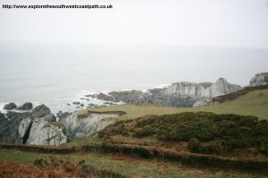
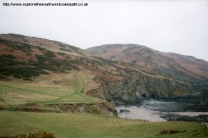
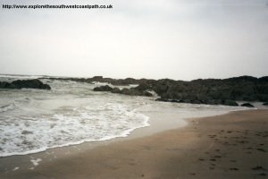
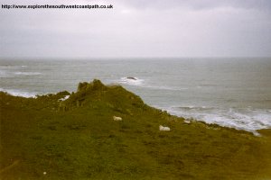
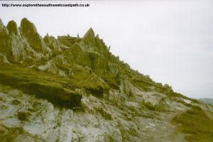
After leaving Rockham Bay, the path goes round Morte Point. This is a very rocky headland, with some unusual rock formations. The path runs at a low level around the headland and as you reach the tip of the headland, there are excellent views towards Woolacombe and Baggy Point. As you round the headland, the path continues at a fairly low level until it reaches the road for a short while near Mortehoe. There is a small amount of walking by the road until Barricane Beach. This is a sheltered and attractive cove. The sand here is made of broken shells, and it is famous for the shells which get washed up here. There is a small cafe at the back of the beach which opens in the summer months. Then it's just a short walk into Woolacombe.
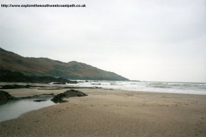
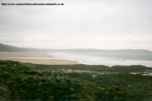
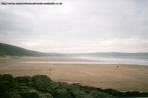
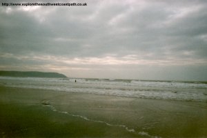
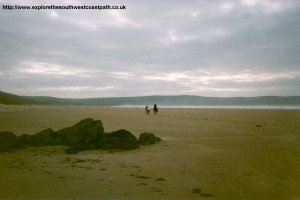
Woolacombe is a popular resort, mainly because of it's excellent beach. The beach extends for two miles to the south and is soft golden sand. The beach is west facing, so is very popular with surfers. The waves can get very large here. There are some sand dunes at the back of the beach too. The village is quite small, but has good facilities, including several Hotels and Pubs, as well as a pitch and putt course. The beach can get busy near the village, but if you walk further south towards Putsborough it is usually quite quiet. If you're returning to Ilfracombe by bus, the buses leave from the shelter just back from the beach on the main road.
Buses run hourly from Woolacombe to Ilfracombe (more frequent in the summer season). The buses do finish quite early though (17:25 in the current timetable). There is also a service to Barnstaple, which is less frequent, but does run later, with the last bus leaving Woolacombe at 18:35 (except on Saturdays when it is earlier). For more information on all these services, see the links below or call 0870 608 2 608.
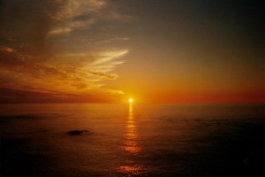
Here are some photos of the walk. The day I walked from Ilfracombe to Woolacombe was overcast. However, I've done the walk from Ilfracombe to Lee Bay a couple of times, so the photos of this part of the path were mostly taken on a different day with better weather. Click each picture for a larger version and description.
 |
 |
 |
 |
 |
 |
 |
 |
 |
 |
 |
 |
 |
 |
 |
 |
 |
 |
 |
 |
 |
 |
 |
 |
 |
 |
 |
 |
 |
 |
 |
 |
 |
 |
 |
 |
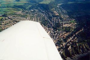 |
| An aerial photo of the Torrs Walk from Andrew Vincent, ilfracombetown.com. |
Ordnance Survey Landranger map 180 covers this area of the coast path and is available from most book shops nationwide. It is also stocked at the Ilfracombe and Woolacombe Tourist Information Centres.
![]() Multimap is a web site which provides maps of the UK, including around Ilfracombe, Lee and Woolacombe. The links below will be of most use to the coast path from Ilfracombe to Woolacombe. These maps join to provide the complete coast path between the two points.
Multimap is a web site which provides maps of the UK, including around Ilfracombe, Lee and Woolacombe. The links below will be of most use to the coast path from Ilfracombe to Woolacombe. These maps join to provide the complete coast path between the two points.